I don't really want to blog about dipnetting, but it is the ultimate "Alaskan" experience so I feel obligated to.
My cousins go dipnetting at the mouth of the Kenai River every year, and most years they seem to come back it seems just a few hours later with 30-60 salmon. Each head of household is allowed 25 salmon, and each additional person in the family gets 10. Our family of 4 could get 55 salmon. Figure at 7 pounds apiece, that would be 385 pounds of salmon we could can, freeze and smoke. It's free food, in terms of money, but it is costly in terms of equipment and time.
We tagged along with my cousin Kelli and her husband Todd when they went dipnetting Tuesday. We didn't know a thing, and we borrowed their (and my aunt and uncle's) equipment, so it really felt like going along for the ride. We had to buy an Alaskan fishing license for $24, which is good for all fishing for the whole year (just for Douglas). The best dipnetting is 2 hours before and after the high tide; we got there at 9:30, just after high tide.
The process: People have 10-15 foot poles with huge nets on the end. Everyone has chest waders on (and occasional wetsuits or drysuits) and they stand side by side, shoulder to shoulder, for maybe a mile or so up and down the beach at the mouth of the Kenai, Kasilof or Fish Rivers on the Kenai Peninsula (there are other places to go, I believe, but these are the most popular). They stand there and hold their net until a fish swims into it. Then they drag it ashore where they usually have someone who bonks it with a club, pulls it out of the net, bleeds it, cuts off its tail fins (state law), rinses it off and tosses it in a cooler standing nearby. Some people actually fillet them on the spot, but most people don't.
Doug and Todd were out there for 3 hours. Doug, standing near the shore with a net, didn't get any fish. Todd puts on a wetsuit and flippers and floats down the river, comes in to shore, then walks back upstream. He had the best day of anyone we saw: he got 7 fish. A few days earlier 68,000 fish went through the counter 18 miles upstream. The day before, 29,000 fish went through. So it's a guessing game of how many fish are going to come through the day you go dipnetting. We were not in luck, and though we learned a lot, I was very disappointed. We spent 5+ hours in the car getting to Kenai to fish, plus gas money, for no fish to take home. I'd had visions of filleting till the wee hours of the morning. Ha.
People from Anchorage take a week and they camp out, dipnetting every day. Diamond M Ranch is packed in July. They have a nice setup: a fish cleaning station and free freezer space, and they're only a few minutes from the river. Most people camp on the beach at the mouth of the river or at campgrounds all over the area. The stores are overflowing with people, and smokers, nets, waders, coolers are hot items. There is a craziness to life around Soldotna and Kenai in July as the population of Anchorage descends upon them.
Now we have to decide if we're going to stay in Alaska long enough to make the investment in dipnetting equipment worth it!
Alaska is a big place and no blog could sum it up. This is my slice of life living in Homer, Alaska.
Monday, July 28, 2008
Garden Update
I have been meaning to give garden updates before this, but haven't been around to snap a picture & blog--or else have been too embarrassed by how pathetic the garden has looked.
One month ago, at the end of June, I didn't know if I would get anything out of this garden. My cabbages, broccoli and cauliflower (C-B-C) were dying left and right, you could hardly see most of my kohlrabi plants, and my spinach and lettuce had sprouted but weren't growing. While it has been a very cool summer (some say the coldest since 1952), the garden is finally looking respectable.
My C-B-C died and I replanted 3 times. I ran out of my own plants so ended up going to the greenhouse and buying some. I'd been so careful to label each brand and type of plant, but after all those replantings, I was just throwing things in wherever there was a space. I have 70 C-B-C plants now, on last count, though I will just have to wait and see how many of each I get!
My spinach, seen in the raised bed in the foreground, is pathetic looking still. I put compost in the bottom, but then put regular dirt on top of it and didn't mix it up. That is how everything in the garden would be doing if I hadn't added 6 inches of compost/manure to the top last year. The romaine lettuce in the bed on the other end has finally begun to grow, after repeated fertilizing and lots of rain. We now have as much lettuce as we want to eat from that, and it is delicious!
In my coldframes, my zucchini is doing very similar to the spinach: small, pathetic plants (the soil is the same: hard clay when dry; muck when wet). However small the plants, they are loaded with blossoms and I noticed my first 2 inch zucchini on a couple days ago. Since it has been so cold I've left the wooden ends on all this time. My daughter asked me a few days ago how the blossoms were going to be pollinated. Good question! Now the boards on the ends are off and I'm hoping the bees come to visit!
All my plants (carrots-peas-onions-potatoes) are now pretty much on schedule and looking vital and healthy. I doused the bases of the C-B-C and kohlrabi in fish gurry yesterday to ward off fly larvae. It has rained for a couple weeks and now it is sunshining so that's the best recipe for success I think. Nothing much seems to produce till August anyways, and then we'll have to eat fresh stuff like mad!
I turned my compost for the first time this summer (I know, you're supposed to turn it regularly to give it air, etc. etc.) and it was HOT! Some shredded paper I put in there within the past week was browned--as in slightly burned! So despite not turning, it will still turn into compost! I have put in rotten barley, horse/cow manure, grass clippings, straw, household vegetable scraps, shredded paper and salmon leftovers/eggs (raw-after filleting). As you can see from the picture, I have a second compost bin started (as of today!). My other one keeps getting filled up, and I am discovering areas of the garden that are going to need significant infusion of "good stuff" for plants to do well next year!
The horsetail isn't too obvious in this picture, but it is an annoyance. It is solid between my rows of C-B-C, though I have pulled it when it is near the base of the plants. The other side of my garden, that is not in hills, is staying relatively weed free after 2 or 3 intensive weeding sessions. Someone told me to use a hoe to chop up the horsetail, time and again, and it will stop coming back, but my vegetable plants are so large now I'm afraid I'll damage them while doing so. And plenty of other gardeners have told me to give up on the horsetail, so I don't worry about it too much (after all, I'm sitting here blogging about it rather than out there weeding!!)
My basil is going gangbusters in my house, and my window sills are covered with them. I have one plant each in the little 3x3x3 planters (2 flats full, plus 5 big pots with 5 plants each), and amazingly, they are still growing and producing! For awhile I kept them too moist and they started getting the wilts, but now I let them get quite dry before I water them. This has been my greatest gardening joy of the year (fresh pesto--yum yum!), and next year I'm going to grow more greenhouse plants in the house. I want fresh veggies--and the plants love our sunny window.
If I had to do this over again,
- I would have probably planted later (my first planting was the last week of May), though most years that would have been ok.
- I would have had plant covers for my plants (I didn't round up enough milk cartons to cover all my starts until my third planting), I would have taken off the caps and just left the cartons on till the end of June rather than taking them off and back on each day.
- I'm still out on whether I'll do my starts or just buy them next year. It is a hassle to start, and by time I buy starter soil, not much cheaper than just getting plants.
- I would have made sure I put compost/manure over the whole garden last year (I missed a few sections and the plants are suffering in the clay).
- I would have started my second compost bin sooner to take advantage of more grass clippings and other compostables.
- I would also have fertilized sooner and more often.
- A bunch of my plants suffered at one point when they got too dry (didn't get watered for a few weeks), and some of them died. I would have watered immediately upon coming home, rather than weeding for 3 days and then watering.
Wednesday, July 23, 2008
Glacier and Wildlife Cruise
Everyone I've talked to who has taken a glacier and wildlife cruise out of Seward has said it was well worth the time and money, so, on impulse, we decided to do one out of Valdez since we were "in the area!" It was very close to the Chilkoot Trail as a highlight of our trip, and I think the memories of this cruise will probably last longer than the Chilkoot for it's "coolness" factor. I think we may have been the only Alaskans on the boat; there were people speaking other languages, and the guest book showed a spattering of people from all over the U.S.
We went on a 9-hour Stan Stephens cruise out Port Valdez to the Columbia and Meares Glaciers, and then back by Glacier Island and Bligh Reef. Meals were provided, and the food was delicious! I don't have the chance to say that often about mass-produced food, but the Oreos for dessert were my only complaint!
These two Stellar Sea Lions are comfortable on Buoy #9. At times there are up to 9 sea lions on this buoy and it sinks, as the sea lions are 650 lbs. (females) to 1200 lbs. (males).
Columbia Glacier is behind 2 miles of floating ice, so this is as close as we could get to it. Here the water is only 30 feet deep, but where the glacier calves the water is 1500 feet deep. The different colors of ice indicates how compact the ice is--the more blue, more compact the ice. The air was cold and I put on my winter hat and gloves and piled on sweatshirt and jacket as we drifted near the bergs.
The six hour cruise only goes to the Columbia Glacier. We went on to the Meares, which was much more impressive, and, amazingly, is one of the few glaciers in the U.S. that is growing (they listed 2 others in Prince William Sound that are growing as well; they don't know why).
Visiting Meares was one of my top favorite glacier visits. We didn't see any huge calving (when pieces of the glacier break off and fall into the water), which was disappointing, but it was still incredible hearing the loud, sharp creaks, snaps, pops and groans of this glacier. There were harbor seals on ice floes all around us at the base of the ice. Once again, the immensity of glaciers astounded me.
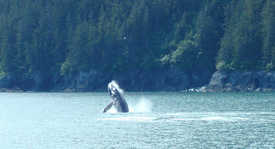
I'll be honest, I went on this cruise to see the glacier calf, and if I got any wildlife out of it, then that would be nice. Turns out the wildlife was spectacular. This humpback whale breached 6 or 7 times right next to our boat. Next time I won't spend all my time trying to get a video of it--I'll just watch it and go "wooooow!" with everyone else. My video clips show lots of splashes! There were 3 whales in this area off Glacier Island, and it was funny because although there were dozens of sea lions lounging and playing on shore right by the boat here, all eyes were on the water looking for the whales.
This is a video of the Dall's Porpoises, one of my favorite parts of the cruise. We saw them playing in the water in the distance, and pretty soon they were swimming with the boat (they can go up to 35 mph; our boat went about 23 mph most of the day). I was upstairs and didn't get down to the outside deck in time to see them and was so bummed, but when they came back I was ready! As we watched the porpoises play with the boat, we noticed some incredible jellies? jellyfish? floating in the water. They were all sorts of colors, shapes and sizes, and the water must have been so clear for us to see them.
Near the end of the day as we headed back into Port Valdez I saw a dark gray dorsal fin cut the water next to our boat. I was going to call out to the captain and ask him what it was, but it disappeared too quickly. It reappeared again briefly. When we asked the captain about it he said it may have been a salmon shark,which normally only surface once or twice.
The sea otters were too numerous to count, and were seen floating along with the babies on the belly of the parent. We saw a black bear, a Sitka black tailed deer with its baby, an eagle sitting in its nest, puffins and other seabirds. We saw a harbor seal gulp down a fish, and we saw fishing boats nearly swamped as they pulled in netloads full of salmon. It was just an incredible day. OK, I guess I do have a whale breaching video--slightly more than a splash since they go so fast!
And here are some sea lions playing and hanging out. Enjoy!
Valdez, Alaska
Once again, we decided that "since we were in the area" we ought to go check out Valdez. It was only 111 miles out of our
way (one way!), to get to Valdez from the Tok Cutoff, our turnoff towards Anchorage. From Homer it would be about a 12 hour drive. We spent 1 1/2 days in Valdez, and it is high on my list of places to return to. Since my camera was back in operation, I shall return to the photo journal format!
The Worthington Glacier barely gets mention in my Mileposts, but it was very neat because 1-it was deserted! The day was so yucky no one was around and 2-we could hike right up to and on it! The picture on the upper right is the big picture (that we took 2 days later on our return trip; it was covered by clouds the day we visited it). The picture on the left of the kids at it was down the lefthand arm near the terminus. I've seen so many glaciers lately, and I see them everywhere I go in Alaska, but this was our first time so close to one. I was struck by the sheer immensity of it. We felt like we were close to it, but it was still quite a hike up, then down over the moraine, and then you're standing right next to it and the ice just soars off way above your head into the clouds. Wow. It is on the drive from Glennallen to Valdez, just before Thompson Pass.
After Thompson Pass, about 12 miles out of Valdez, the sheer cliffs of Keystone Canyon rise above the road and river. Two incredible falls drop down from the mountains above it: Bridal Veil Falls (shown here) and Horsetail Falls (Seems to me there was another one, but it is not on the map. Could have just been rain runoff.). This area has a lot of history as it was the first glacier-free route from Valdez to the interior.
The Trans-Alaska Oil Pipeline roughly follows the Richardson Highway, so every so often we caught glimpses of it. In some places it goes underground, but where the oil would warm and melt the ice in the tundra it is above ground. The Alyeska Marine Terminal in Valdez (pictured here) is where the tankers fill up with oil after the 800 mile journey across Alaska from Prudhoe Bay. This is pristine Prince William Sound, and as we traveled around viewing wildlife on the cruise the following day I could picture the horrific mess of oil covering the animals, water and shoreline. Now the supertankers have tugboat escorts through the Sound to help stop them quickly if there is risk of colliding with an iceberg. The glaciers are calving often, so there are many icebergs scattered about that make this a very real threat. It takes the tankers over a mile to turn, and more than that to stop.
My sense of Valdez was remoteness: the town itself got 500 inches of snow one year recently, and the nearest town of any size is Palmer (near Anchorage), nearly 6 or more hours away via a mountain pass where they get even more snow (100-200 feet in some places in the mountains). One can also get there by boat, dodging all the fishing boats and glaciers. I could see making Valdez a destination vacation, and judging by the number of RV parks in town (they were all packed, despite high gas prices), many other people do too. There were hiking trails and other glaciers to explore, museums to visit and restaurants to try. Each town has its own "feel" or atmosphere, and I something about Valdez struck a chord with me. We often ask ourselves "Would we want to live here?" as we travel around Alaska. This is one of the places I think I might say yes! I'm a bit leery of all that snow, though!!
Haines, Alaska
We chose to return to Homer via Haines rather than Skagway on the recommendation of a friend. It cuts 55 miles off the trip (not very much), but the ferry ride was 2 hours shorter and thus cheaper. I am glad we went this was because it was so incredibly different from the drive down the South Klondike Highway to Skagway.
Haines is a town I have little desire to go back to. I would like to check out the Chilloot Lake State Park, just out of curiosity, but besides that, there didn't seem to be much of anything there. The Southeast Alaska State Fair is held in Haines each year, which I can understand, because it has more space than Skagway (though I'm surprised they don't hold it in Juneau, which is centrally located)
We stayed at the Salmon Run Camping and Cabins. The plan had been to camp, but our tent was still wet from a rainy night in Skagway 2 days prior, and it was pouring rain when we left Juneau, so we tracked down a reasonably priced place as we sat in the queue to board the ferry (they were an hour late leaving Juneau because of a medical emergency in the car loading area). Every hotel and cabin we called was $130/night, which was definitely not worth it for us, but the Eagle's Rest had very nice new camping cabins for $60/night. We got the best night's sleep there that we'd had in weeks, we got all of our stuff dried out, and so we didn't feel about about the fact it wasn't raining in Haines! A black bear had wandered through the campground 10 minutes before we got there, so the kids were very happy to be in a cabin rather than a tent!
It is estimated that you will need 4 hours to drive the 152 miles of Haines Highway from Haines to Haines Junction (where you're back on the Alaska Highway). That turned out to be just about right, with a 45 minute wait at the border crossing into Canada (they had a mean, drill-sergeant type lady who was grilling everybody that came through; there were only 8 cars ahead of us for the 45 minute wait!) and an hour stop for lunch and a quick hike at the Million Dollar Falls in the Yukon.
There were not the steep, tree-covered canyons of the S. Klondike Highway into Skagway, and the two highways, separated by not more than 50 milesas the crow flies, could not be more different. The Three Guardsmen Pass (at 3,215 feet) and Chilkat Pass (at 3,493 feet) were up above treeline, and though the mountains on each side of the road towered above us, it still felt like we were driving on the top of the world. The road reminded me of driving out the northeast entrance of Yellowstone: wide-open vistas, rocky mountains, snow patches along the road and just that sense of being high (I just re-read what I wrote, and John Denver's song, Rocky Mountain High, comes to mind!). As we crossed the passes we gradually made our way back into the trees and it became what I consider typical Canadian Yukon wilderness: trees, trees and more trees, with mountains in the distance.
The wildlife of the day was a grizzly on the side of the road gorging itself on dandelions. (Are you wondering why I have a picture?? The kids were looking at pictures on camera as we drove along, and so on a whim I decided to see if it worked, and it it did! I was back in picture business!). When we got up in the Yukon we also saw a baby mountain goat cavorting along on the side of the road (we thought it was a baby sheep at first!), a black bear and swans.
We nearly made it back up to the US border, despite an hour long roadwork delay along Kluane Lake where we got out and played catch with the softball, broke out the snacks, and chatted with people from all over the U.S. who were in the cars around us. (As we were told, the blasting crew made more of a mess than they bargained for and it was taking them a long time to clean up. We had a 45 minute wait at the same spot last year when we came through with our U-Haul. On our way through a week before it was about 11 pm, so we cruised on through without a hitch.) We couldn't trust our Milepost Magazine since many of the places they said had restaurants, gas, etc. were closed. We finally found a campground that wasn't in our Mileposts and had a good night's sleep until the crows woke us up the next morning.
Alaska Ferry
Juneau (and I am guessing much of Southeast Alaska) gets 271 days of rain/precipitation a year. Thus it is no surprise that it was overcast and cloudy on both the ferry ride from Skagway to Juneau and again from Juneau to Haines. However, it was so pleasant both ways that we didn't mind too much.
The Alaska Marine Highway System is quite an impressive public transportation system. Every day during the summer months boats are ferrying people, cars, campers, semi-trucks and more from one community to another. Most of the ferries are centered in the Southeast Alaskan arm from Skagway down to Ketchikan (also known as the Inside Passage since the boats are in channels between mainland and islands nearly the whole way), Prince William Sound and the Aleutian chain. There is a cross-gulf ferry that connects the two systems (the Inside Passage route appears to run independently from the Southcentral/Southwest routes). The rates were reasonable, and the boats comfortable.
Our boat, the M/V Malaspina, runs from Skagway to Haines to Juneau each day so it does not have any private cabins available. There were 4 floors that the public could access: the lowest is where we drove into and parked our car for the voyage. There was a solarium, recliner lounge, cocktail lounge, dining room, forward lounge, gift shop and cabins. Movies were shown regularly, showers are free and towels are provided, food in the dining room was priced right, and we could wander about at will. We sat in the recliner lounge which, along the windows, had 6 comfortable seats around a table, with plug-ins so we could charge all our electronic stuff. We shared it with my cousin and her husband on our way to Juneau (they were taking off for a 3 week kayaking trip), and on the way back spent it chatting and playing cribbage with a couple from Switzerland (they caught on quickly with Denver teaching them!) .
On the way to Juneau we saw one whale close to the ship, and many of them off in the distance. They were easy to spot as they would "blow" and the spray would hang in the air for a few seconds, looking like a small patch of mist above the water. We also saw a whole group of harbor seals in a cove along the shore. As I mentioned before, Alaska is a land of glaciers and mountains and waterfalls, and we saw all of these despite the low cloud cover. It was a very peaceful and comfortable journey. I could not even tell the ship was moving until I looked out the window. Then I thought the water was flowing by us like a river--not that we were the ones that were moving! We are already planning a trip out along the Aleutian chain and look forward to it!
Side trip to Juneau
This is coming a few weeks after the fact since we've been traveling much. We are finally home, so I get to catch up on blog entries!
Juneau is a 6 hour ferry ride from Skagway (more on the ferry in another entry), and it is such a long ways from Homer that we decided to bop on down for a couple days since we were in the area. It is locked in by mountains, and I read in the book Avalanche! (I forget the author; an Anchorage resident; a great read!) that many homes are in avalanche zones, so I wanted to see this place that I could only picture in my mind. Juneau isn't as wild and remote as I imagined it (and yes, plenty of homes are in avalanche zones!), and yet it is remote enough that I wouldn't want to live there. It has a population of about 30,000, 91 miles of roads, and hundreds of miles of hiking trails (the one reason I want to spend more time there!). It is pretty much like living on an island, so to go anywhere you must fly (expensive) or ride a boat (slow). That would drive me nuts.
Downtown Juneau was very cool! I am not a big shopper, and we really didn't shop much, but it was fun to walk the cozy (read: old!) streets with the crowds of tourists from all over the world. Up to 5 cruise ships can dock right in downtown Juneau, and the 2 days we were there at least 2 huge ships did dock each day, with a fresh crowd of people pouring out into the streets to shop and say they'd been to Alaska. Since nearly everyone who comes to Juneau does not have a vehicle, the tour business is huge, whisking people off to the Mendenhall Glacier, Juneau Icefield, wildlife watching cruises, kayaking, zipline adventures, etc. We decided to bring our car down by ferry so we would have the freedom to go where we wanted.
Here are the places we visited, and a summary of the features or highlights, from our perspective. My camera still wasn't working, so no pictures! Sorry!
Mendenhall Glacier: The visitor center here is really nice. It was a treat to watch mountain goats (including a baby!) jumping around the mountainside above us through the high powered telescopes in the visitor center. The movie in the auditorium was interesting, and all the staff was very friendly. We hiked the 3 1/2 mile East Glacier Trail to get a closer view of the glacier, but it didn't get us much closer, and from that perspective it wasn't worth it. The trail was nice, very similar to Day 2 of the Chilkoot trail: hilly rainforest, with everything covered with moss. Supposedly bears are seen on the trails around the glacier daily, so though it felt quite tame, we tried to keep up our bear awareness.
Alaska State Capitol Building: Tours are offered every day, and while it wasn't an exceptional tour, it did explain what was what. I really enjoyed the historic pictures that lined the walls of all 3 floors. The legislature wasn't in session, and it was the day after the 4th of July, so all was quiet.
City Museum: This was conveniently located across the street from the State Capitol building in the old Juneau library. It had a whole room dedicated to motorcycle memorabilia (apparently Juneau has a very high per capita motorcycle ownership), a very interesting video about the history of Juneau, and a fun hands-on kiddy room. If I didn't have much time, I wouldn't consider going there again. We did appreciate that kids under 18 were free, as they were at nearly every tourist place we went to in Juneau.
Alaska State Museum: This was very nicely done, and we especially enjoyed the art gallery of entries of an Alaskan photo contest. The kids liked the children's play room where there was part of a ship to climb on, as well as an I spy creation taking up most of one wall where they had to find small toys in a conglomerate of items. There was also a raven board game on the main level in the Raven Room that the kids enjoyed too. The free lockable lockers were a treat so we didn't have to carry our backpacks the whole time we were there. It was a nice size museum (not too big, but big enough to be worth it), and I would enjoy going there again.
Centennial Hall Convention Center Visitors Information: The ladies here were very helpful and pointed us in the direction of 4 playgrounds/parks/trails that weren't on our map. We have learned that in order to find the parks the locals go to we have to ask around, because they don't put things like that on tourist maps. Here are some of the places they recommended:
Rain Forest Trail: This is on Douglas Island across the channel from Juneau (Douglas was a bigger city than Juneau in its heyday at the height of the gold rush) and a 10 minute or so drive north along the shoreline. The skunk cabbage plants were huge, the trail was very nice and easy (which we appreciated after the Chilkoot!), and meandered down to the beach through a beautiful rain forest. We didn't spend a lot of time there, but I would go back so we could explore more of the trails.
Cope Park: This park has a frisbee golf course, a tennis court, pavilion, awesome waterfalls that go on and on, a spillway and rough trails. Then we discovered the placer by accident. This park is on Gold Creek, which was one of the first creeks to have gold discovered along it in the 1800's. The original placer, or trough that water would run through, was still there, and they built a walkway on it, so it is now a popular hiking trail. We took that, and came out in town somewhere, so ended up getting a walking tour of the back streets of Juneau as we made our way back to our car and the park. We would NOT want to live in Juneau in the winter: the streets are narrow, winding and very hilly, and they get a lot of snow!
Big, very cool playground: That's not the official name of it, but it is by Twin Lakes and the hospital as you head out of Juneau proper and towards the airport and ferry dock. It is like the Imagination Station in Kalkaska--one of those big wooden playgrounds that kids get lost in. This one was made almost entirely out of the plastic boards (like Trex) so it will last forever. It was very well designed, with a separate small kid section, some big slides, shelters for the parents to sit in, a picnic area, and even a lake with a small beach right next to it. Our kids begged for an hour there, and it was not close to enough. They talked of it in terms of their "dream playground". Maybe they'd just had enough of grown-up hikes and were desperate for kiddie time!
To sum up Juneau: It is a nice place. We like it. The biggest downfall is just that you can't drive beyond the 91 miles of roads. I wouldn't want to stay in a hotel downtown again since we had to park 5 blocks away in the city lot. Next time I would look for a cabin or house rental (there were some reasonably priced ones that we found out about later). Next time we visit we'll be out on the trails hiking rather than exploring the city. But we will most definitely go back to the Mongolian restaurant on the corner of Seward and Second Streets: it was an awesome, choose your food and spices and they grill it as you watch place. And next time we'll hope Olivia's Mexican restaurant on Seward Street is open (it was closed for the 4th) since it came highly recommended by a local we talked to.
Saturday, July 12, 2008
Chilkoot Trail
Here we all are, ready to begin our first leg (4.9 miles to Finnegan Camp) at 3:30 p.m. We were nervous and excited and very ready to finally begin the journey we'd planned since February. Actually, we're missing Angela & Klaus in this picture. They were the ones who planned this whole thing, then invited the rest of us. Their car broke down in Tok, Alaska, and it took 2 days to get a part there and fix it so they started late and did not catch us until Day 4 at Lindeman City. We are a mixed group: from Denver who is 8, to John who is 71. Aurora ended up being the speediest hiker, out front most of the time though trading the lead with Denver ocassionally.
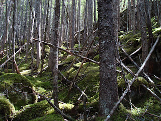
This was taken on Day 2 of our hike, from Finnegan to Sheep Camps. It was by far our most difficult day hiking. While the overall elevation change for the day was less than 1000 feet, we probably went much more than that as we went up and down, up and down, up and down hill after hill through the rain forest pictured here. It was incredibly beautiful, with trees and rocks and everything covered with thick moss, but the trail was rocky and rough, and while it was only 8.1 miles, it took us 8 hours to hike it. In retrospect, we should have stopped to eat lunch before 3:00 in the afternoon, and perhaps take more breaks as well.
When I first saw the pass, I thought to myself, "We're going up THAT????!!!!" In the picture here, the Chilkoot Pass is the snow going up on the left, also known as the Golden Stairs because in Gold Rush days, steps were cut out of the ice and snow for the men to climb with their required ton of goods that they had to have to pass into Canada (at the top of the pass). The pass to the right is Petterson's Pass, and it is longer and less steep than the Chilkoot. This is the pass that 70 people were killed in an avalanche April 4, 1898.
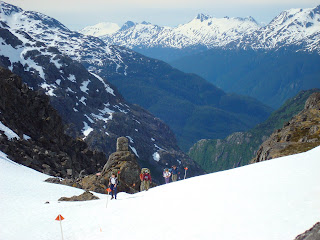
Here you see the bowl that we just came from and we're leaving snow and now have a climbing job ahead of us over the jumble of rocks. I was much more comfortable climbing these rocks than on the snow. In one spot on the snow Denver slipped and fell, and there was a steep snow slope that lead to a dropoff and cliff. It was the only area I roped him to me, though if the weather had been worse, I probably would have roped up in other areas as well, since the risk was definately there. As we told the kids later, we would never let them play in an area like where we hiked.
Here we are further up the Golden Stairs (the gold seekers did this in winter since transportation over snow is much easier than over rocks). When we look at this picture we just shake our heads and say, "We did that??!!" It didn't seem that bad when we were on it, and in fact I had more fun climbing those rocks than any other part of the whole 33 miles.
Once we climbed the rocks, we still had a ways to go over snow to get to the pass. Once again, we didn't quite realize what we were getting into before we did this. I don't think of myself as doing this type of backpacking, especially not with an 8 and 10 year old! But when you are there, you just have to keep going. We just kept putting one foot in front of the next till we got to Happy Camp, 8 miles from Sheep Camp, 9 hours later. It was a nearly 2700 foot climb from Sheep Camp to the top of the pass. We started at 6 am (they recommend an early start to avoid soft or melting snow) and reached the top of the pass at 10:30.
This picture reminds me of The VonTrapp Family in The Sound of Music--up on the top of the mountain with packs on their backs. See the valley down there? That's where we came from just that morning.
Mid-June to mid-July are considered "early season" on the Chilkoot, and mid-July and August are peak season.
Over the pass! Now we're heading down to Happy Camp. They told us it was 80% snow over the pass, and I couldn't quite picture it. They were not kidding. The snow was deep, and there were places where if you slipped, it would be down a slope into a snow crevass, lake or cliff. At this level, the lakes were just beginning to thaw.
Our first day hiking started with some rough, rocky climbs, but then flattened out. Here was a boardwalk where the trail goes over an area flooded by beaver dams. There was dam after dam, and this was an interesting area to walk through. The challenge was we met another party coming from the opposite direction, so we had to scootch around each other with our packs on.
The bear avoidance tactics were extensive: in 3 of the 5 campsites we stayed at we hung our food, fuel and smellies. In Sheep Camp we used bear boxes (as seen to the right of the cooking hut in the next picture), and at Happy Camp there was a building to put foodstuffs in.
In every site there was a cooking area. No food was to go near the tents. Earlier this year a bear entered a tent in Sheep Camp where they cooked in their tent, despite all warnings not to do so!
We did not see much bear scat on the trail, though in one area many rocks were overturned and the moss ground up, which may or may not have been bear.
Every camp on the US side (there were 3) had a cabin like this to warm up in. We didn't need them on the US side since the weather was great, but we sure would have appreciated them on the Canadian side. Happy Camp (first camp over the pass) had a cabin, but no stove, a couple others had no cabin, but luckily Lindeman City had a cabin with a stove so we stoked it up and got all of our clothes, tents, pads and sleeping bags dried off from the heavy rain the night before.
This was taken on Day 2 of our hike, from Finnegan to Sheep Camps. It was by far our most difficult day hiking. While the overall elevation change for the day was less than 1000 feet, we probably went much more than that as we went up and down, up and down, up and down hill after hill through the rain forest pictured here. It was incredibly beautiful, with trees and rocks and everything covered with thick moss, but the trail was rocky and rough, and while it was only 8.1 miles, it took us 8 hours to hike it. In retrospect, we should have stopped to eat lunch before 3:00 in the afternoon, and perhaps take more breaks as well.
When I first saw the pass, I thought to myself, "We're going up THAT????!!!!" In the picture here, the Chilkoot Pass is the snow going up on the left, also known as the Golden Stairs because in Gold Rush days, steps were cut out of the ice and snow for the men to climb with their required ton of goods that they had to have to pass into Canada (at the top of the pass). The pass to the right is Petterson's Pass, and it is longer and less steep than the Chilkoot. This is the pass that 70 people were killed in an avalanche April 4, 1898.
Shortly after we entered this bowl below the pass, a grizzly bear walked across the path in front of us. We were wondering what we were going to do, thinking he was trapped in the bowl and that would not be a good thing for us, who were at the entrance of it! However, he headed up a chute to the left of the Golden Stairs, not looking at us once. He seemed to be ambling so slowly, yet he cruised over the snow and up the rough rocks like they were nothing, and within 10 minutes was out of sight. This was once of the more exciting moments on this hike for the kids. It was very cool.
Here you see the bowl that we just came from and we're leaving snow and now have a climbing job ahead of us over the jumble of rocks. I was much more comfortable climbing these rocks than on the snow. In one spot on the snow Denver slipped and fell, and there was a steep snow slope that lead to a dropoff and cliff. It was the only area I roped him to me, though if the weather had been worse, I probably would have roped up in other areas as well, since the risk was definately there. As we told the kids later, we would never let them play in an area like where we hiked.
The trail was well marked with orange poles on the US side, and orange flags on the Canadian side. As they say, it is more a route than a trail. In some areas lower down we were actually hiking on snow over rivers. I can't imagine all this snow melting every year, but apparently it does.
Here we are further up the Golden Stairs (the gold seekers did this in winter since transportation over snow is much easier than over rocks). When we look at this picture we just shake our heads and say, "We did that??!!" It didn't seem that bad when we were on it, and in fact I had more fun climbing those rocks than any other part of the whole 33 miles.
In gold rush days they had a cable on a pulley system that horses hauled goods up the mountain. We saw a picture of the horses going up the pass. They were going up so steeply it looked like they must surely fall over backwards!
Once we climbed the rocks, we still had a ways to go over snow to get to the pass. Once again, we didn't quite realize what we were getting into before we did this. I don't think of myself as doing this type of backpacking, especially not with an 8 and 10 year old! But when you are there, you just have to keep going. We just kept putting one foot in front of the next till we got to Happy Camp, 8 miles from Sheep Camp, 9 hours later. It was a nearly 2700 foot climb from Sheep Camp to the top of the pass. We started at 6 am (they recommend an early start to avoid soft or melting snow) and reached the top of the pass at 10:30.
This picture reminds me of The VonTrapp Family in The Sound of Music--up on the top of the mountain with packs on their backs. See the valley down there? That's where we came from just that morning.
When we reached the Canadian border the park ranger there said we had the first nice weather of the entire season. Two days later when the late members of our party crossed the pass, it was raining and cloudy, and they were shivering with cold nearly the entire day.
Only 50 people a day are allowed over the pass. The day we crossed less than 15 people went over. Two days later, in the rain, nearly the maximum crossed over. Our experience was much better because we had most camps all to ourselves, so we didn't have to share the warming huts, cooking huts, bear poles, etc.
Mid-June to mid-July are considered "early season" on the Chilkoot, and mid-July and August are peak season.
One of the biggest disappointments for me on this hike is that we did not see more relics along the trail. We'd heard over and over that there were lots of cast-offs from gold rushers, who as they climbed the pass would cast off things to lighten their load. I suspect most items were under the snow. There were more relics in Lindeman City than in the pass.
We met a couple archeologists on the trail our second day out who were doing some searching and researching. Metal detectors are not allowed on the trail, but for their job, they were allowed to have one.
Pass rules say not to touch any items on the trail, or if you do touch, to put it back exactly as you found it. In Bennett, the end of the trail where we got on the train back to Skagway, the shore of Lake Bennett was littered with broken glass. I thought it ironic that what we would normally call "litter" is considered "historic relic" in this situation. So no one picks up all that glass because it is "historic".
Over the pass! Now we're heading down to Happy Camp. They told us it was 80% snow over the pass, and I couldn't quite picture it. They were not kidding. The snow was deep, and there were places where if you slipped, it would be down a slope into a snow crevass, lake or cliff. At this level, the lakes were just beginning to thaw.
The snow was actually much easier to hike on than the alternative: rough rocks. It was also more direct. There was no need to follow the contours of the land. It was a gorgeous day. We all got a little sunburned, and I was thrilled to wear shorts for the first time this year to counter my "Alaskan white" legs.
I sprained my ankle near the end of the day hiking over the pass, and my uncle fell through the snow and twisted his knee, so we were in need of rest when we got to Happy Camp. There was plenty of snow around to pop into a ziplock bag (I tried putting my ankle in a creek, but it started hurting within seconds from the cold!), and I iced my ankle for at least 3 hours that evening.
The sad note is that my camera stopped working along the hike this day, so this is the end of my pictures from this trip. The next day was rainy and foggy, so there wouldn't have been any pictures, though I wanted to take one to show how nervewracking it can be to cross steep snowfields in the fog and not be able to see how far you would slide if you fell, or what you might hit at the bottom. That was the most stressful morning of hiking for me, between the rain (slick rocks with a sprained ankle) and fog (no visibility; took some searching to find the trail at times). Luckily the fog lifted and the rain let up to sprinkles and by time we reached Lindeman City it was sunshiny.
The final day hiking we were exhausted by the heat. We were lower, out of the snow, hiking through terrain that reminded me of Arizona: pines, rocks, and sand. At Bare Loon Lake Camp we pumped more water, and I soaked my feet as the kids waded in the lake.
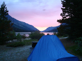
No trains run from Bennett to Skagway on Wednesday, so we had to spend a night at the campground in Bennett. It was anticlimatic, and the end did not seem real. We were nearly out of food, nearly out of fuel, completely out of snack foods, and while we were ready to be done packing, we weren't quite ready to be back in civilization. This picture is of a sunrise over Lake Bennett at about 3-4 a.m. (from my uncle's camera.)
By the next day the people who had crossed the pass behind us were pouring in, and the train station was overflowing with backpacks and tired people. Mingled amongst the backpackers were the genteel folks who were taking a scenic train tour up to Whitehorse. It was an interesting mix. The backpacks get loaded up in an open car, and as you can see in the picture, there were a lot of packs! The train ride back to Skagway went through 2 tunnels and wound around the mountains through the White Pass down to town. There were some dramatic dropoffs, stunning waterfalls and tidbits of history scattered along the tracks.
I'm looking forward to doing the Chilkoot again, and Denver says he is too. Douglas and Aurora are still out on that count, but I'll bet they could be convinced!!
Skagway, Alaska
Skagway is the taking-off point for the Chilkoot trail, so it was our first destination in our trip. I found Skagway to be a quaint, bustling little town tucked into the mountains. It is the northernmost port of the Inside Passage (the channels that run from Seattle to Alaska), and it gets huge cruise ships in daily. At first I couldn't for the life of me figure out why there were so many jewelry stores and fur shops in this town (my estimate: 3 out of 4 stores were for jewelry) until I realized that the cruise ships bring in fresh loads of hundreds or thousands of well-off people every day all summer long. I could just imagine what this town looks like in the winter: boarded up and deserted.
To get to Skagway by road, one must go through the Yukon Territory, a small section of British Columbia, the White Pass, as well as U.S. Customs just outside Skagway. A narrow gauge train runs from Skagway to Whitehorse in Canada, for tourists who want a beautiful train ride and a flavor of interior life. From Homer it was about 1100 miles; realize that we were just travelling to another part of the state of Alaska! It hit me for the first time how remote Southeastern Alaska is: most of the cities can only be reached by water. Skagway is one of the few that can actually be driven to, which makes it a popular taking-off and landing point for travellers (along with Haines, across the inlet a few miles away, but over 300 miles away by road).
Skagway is one of the oldest towns in Alaska (I'm guessing the tourist literature I read that in meant "non-native" oldest towns). It played a significant role in the gold rush of 1898 as prospectors would take the Inside Passage, load up their ton of goods for the 33 mile trek over the Chilkoot Pass, then take a boat (or in later years, train) to down the lakes to the Yukon River, which they would then follow all the way to Dawson City. Of the entire trek the gold rush hopefuls took to Alaska, only 33 miles was by foot; the rest was by water or train. It was that 33 miles which we were about to hike.
We liked Skagway. The RV park on Broadway let us pitch 4 tents on a patch of grass and use their showers for only $20 a night for all 9 of us. The food at the restaurant we went to was awesome (Skagway Brewery? Sorry, I forget). The lady at the laundrymat I went to was very nice, and I didn't feel like, "Just another one of those tourists," even though I came in with a fully loaded backpack of dirty clothes! It is a town we want to go back and visit again.
Friday, July 11, 2008
Alaska Travels....A Reflection
I have 2 days with internet access before I'm gone again, so I'm going to reflect on our past 2 weeks of travels in case I don't get all the pictures uploaded and blog entries written before I'm gone again...
I think of all these pictures I have on my blog so far and places we've been that are beautiful, wild and incredible, and it all seems so small and puny next to the grandeur, beauty and wildness we have encountered in the past 2 weeks. We drove to 1100 miles to Skagway, backpacked 33 miles on the Chilkoot Trail, hopped on the ferry to Juneau, spent 2 days exploring the state capitol, rode the ferry back to Haines, drove to Valdez, spent a day on a glacier and wildlife cruise, then cruised home after many hours in the car.
Life in Homer is such a tiny, microscopic part of this huge state. I am trying to find words to express the bigness, the awesomeness of Alaska. I just keep shaking my head and saying "wow" to myself.
Everywhere we went, there were people from all over the world and from all over the U.S. We spent a few hours on the ferry chatting with a couple from Switzerland, and I said to them, "Switzerland has got to be one of the most beautiful places in the world," and they looked at me doubtfully until I added, "except Alaska," at which point they nodded enthusiastically. When I asked them how the mountains in Switzerland are different from the mountains in Alaska they had a hard time putting a finger on it, except to say that in their country the mountains are squished together, mountain after mountain, and in Alaska they are spread out, there seems to be more space. Yes, space there is. Even I was struck by how far apart everything is, and how remote.
Alaska is a land of mountains, oceans, glaciers, waterfalls and wildlife. It is a land of great extremes and superlatives. It is a young state, by U.S. standards, yet has a rich and romantic history. It seems to me be a place of dreams, a place of searching and exploring. I left on this trip expecting to enjoy some great scenery, and what I have gained is a sense of the richness of what life in Alaska is like--the people and the place. I find myself fascinated and enthralled with all Alaska has to offer and am eager to go off exploring some more. It is a big place, and it may take a lifetime to explore it all!