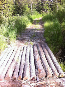
Stetson Creek Trail
 |
| There is actually a trail sign for Stetson Creek! |
My goal for the hike was to get above treeline, and I was thinking it wouldn't take much more than an hour. The other times we'd hiked it we just went for a jaunt from the campground, not taking water or supplies, and not making it more than 30 or 40 minutes out. This time we were prepared with bug spray, water, snacks, extra clothes: the whole nine yards. We hiked like we had a destination, moving along at a brisk clip.
Because we'd always taken this trail from the campground I didn't realize it actually had a name, and we've since seen it on a map. At our brisk pace the trail climbed for the first hour of hiking, in some places gradually and in a few areas quite steeply. After an hour the trail leveled out and followed Cooper Creek up towards the Cooper Lake dam. Across the valley on the opposite mountainside we saw the road that goes up to Cooper Lake dam as well (construction on it right now so it is closed to traffic--bummer!!). We never did get above treeline as the trail continued at the same elevation. I'm not sure how far it goes--going to leave that for another day.
We found out later when we visited the museum that this trail is used by a man who has a mining claim up it (we saw the trail to his camp) and he finds a good bit of gold. It was interesting hearing about the man's camp: a tent with electric wires around it and his equipment with electric wires around it as well--both to fend off the bears. We saw a little bit of bear scat on the trail, more and fresher the further along we got, and very little in the first 45 minutes of hiking.
Here are some pictures from the trail. It is nice walking, particularly as two people can walk abreast, which is unusual for Alaska trails, and it is in fairly good condition in most places, with a few boggy, rocky spots and one small stream crossing.
 |
| There are some pretty sections of the Stetson Creek Trail |
 |
| A small but interesting section of the trail |
 |
| This is as much of a view as we got--not quite above treeline but pretty nonetheless |
 |
| This section of trail was built up with a substantial drainage on the right side |
 |
| My feet got nicely frozen in this short stream crossing! |
Slaughter Ridge/Juneau Peak
 |
| Panorama from the top of Slaughter Ridge with Kenai Lake to the left and Kenai River winding to the right |
 |
| A pretty, mossy waterfall is near the beginning of the Slaughter Trail |
 |
| Evidence of a dry spring and summer: no water or mud where there usually is some. |
Slaughter Ridge is all about the view, and I consider it my favorite one of all the mountains I've climbed (um, maybe after Hope Point, which is amazing as well). The trail is in fairly good shape and is easier to climb than Skyline as there is more distance to go with the elevation change. And it is more official now as there is a notebook at the top under a dishpan, along with some bug spray and miscellaneous foo-foos (like a geocache). We were the first ones up it on July 14th. One person ran up it in 45 minutes and 45 seconds a few days before us. It took us 1 hour and 45 minutes to hike it (1 hour 10 minutes back down).
 |
| View of the ridge we climbed with Kenai Lake in the background |
From the top there are views of Kenai Lake, Slaughter Lake (I think it is) and Trout Lake on the Resurrection Trail. The water is aqua and so pretty, dappled as the clouds go by. We sat at the top for probably 30 minutes, soaking it all up.
Fuller Lakes Trail
As we were heading out of Cooper Landing back to Homer, we decided to spin up the Fuller Lakes Trail. The last time we hiked it was 6 years ago, a week before we were going to hike the Chilkoot Trail in Southeast Alaska. The kids were young, and we all had fully loaded backpacks. We could not remember a thing about that trail, and doing it again, we know why: it is a completely nondescript trail. It is 2.9 miles, a 1400 foot climb, to the lower Fuller Lake. The trail is mostly packed dirt, a gradual climb, with little view. We felt like we could be anywhere in the Midwest. We did it as an exercise hike, so pushed along and managed to get to the lake in an hour and back in 40 minutes, which was a good pace.
Here are a few shots of the trail.
 |
| This trailhead along the Sterling Highway always catches my eye with the nice stairs |
 |
| Not sure why I take pictures of bridges...probably because it is a break in the monotony of the trail |
 |
| The bridge at the lower Fuller Lake; heading on to the upper lake |
 |
| Lower Fuller Lake on a calm morning |
 |
| Doesn't this look like it could be Anywhere, USA? |
No comments:
Post a Comment