We have driven by a number of trails along the Seward Highway south of the Seward Y (that's local's term for where the Sterling Highway meets the Seward Highway) that I have not yet hiked, so with Aurora's time in Alaska winding down, we decided to take a weekend trip down towards Seward to try to get some of those hikes in for me, and sneak in a couple of Aurora's favorites as well. We didn't get to them all, but got some good exploring in.
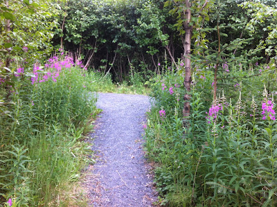 |
| Fireweed lines the trail from the campground to the Ptarmigan Creek Trail |
Ptarmigan Campground is one of my favorites places to stay. It is just past Moose Pass heading south on the Seward Highway, and with only 16 sites, it has a few more tenters than many campgrounds, and therefore fewer generators. It also accepts online reservations (at recreation.gov), which is a huge bonus, though that website is stunningly clunky to use. It does assure a place to stay, though, which is nice during busy weekends.
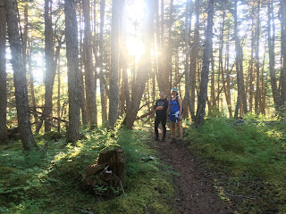 |
| Long Lake Trail--lush temperate rain forest |
That evening after setting up camp saw us dash down the road 10 minutes to the Primrose Trailhead. A few minutes up the Primrose Trail, there is a turnoff with a sign pointing to Long Lake. I've always wanted to explore it, so as our evening stroll, we headed up thataway. It was moderate terrain, with some climbs but not steep ones. The temperate rainforest has its hold here, with moss covering everything, making a beautiful hike. We only went 30 minutes up the trail as it was late. Hiking all the way through to the Grayling Lake Trailhead 6.5 miles away is my goal someday. I have a reputation for underestimating the difficulty of trails, but now that I know what this trail is like, it makes convincing my hiking partners to go with me easier!
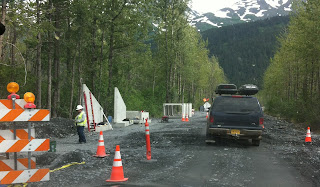
Saturday we hiked at Exit Glacier's Harding Icefield Trail (see other blog post about that hike), after getting stuck in road construction on the park road. We'd been here only a month earlier but since then they'd completely ripped up the road and built it up quite a few feet as well as put in large culverts. It seems like an impressive and ambitious project for a road that only goes to Exit Glacier. I hear it is for flood control. Makes me wonder if they're expecting floods--as the glaciers and Harding Icefield continue to melt at unpredecented rates?
Aurora really wanted to hike Mt. Marathon, so we'd dropped her off at its base before we did our hike at Exit Glacier. A 4000 foot climb on loose gravel and shale was not our idea of fun. It was only her second time doing the full climb and she really enjoyed the camraderie of meeting folks on the mountain as she climbed. Here is a picture of it from our picnic spot in town:
 |
| Mt. Marathon, with the up trail on the right above treeline and the down trail straight down from the peak |
We were tired, but we let Aurora convince us to do another hike up the Seward Highway towards our campground: Victor Creek. So after lunch in a very nice pavilion along Resurrection Bay in Seward, we headed back up the road. The most distinctive feature of Victor Creek is its trailhead, or lack of one. There is just enough space for two cars, and if coming in from the south, a 3-point turn is required to get into the parking lot as one crosses Victor Creek on the Seward Highway and then makes a hard right to get into the lot.
 |
| This trail must not get much traffic as the parking is minimal: 2 cars maximum |
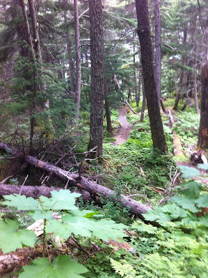
The official USFS trail description says this is a 2.5 mile hike one way, 1100 foot elevation gain. Only 500 feet per mile? Piece of cake! Ha. Nothing is as it seems when one reads the trail descriptions. It was quite pleasant the first 45 minutes with trails looking like these:
 |
| Early on the Victor Creek Trail |
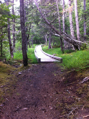
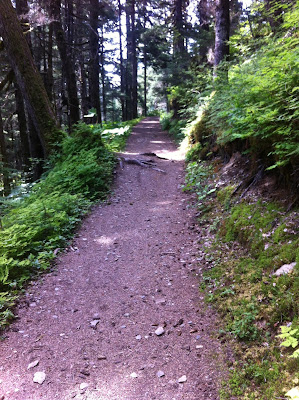
 |
| More pleasant trail winding through the woods along Victor Creek |
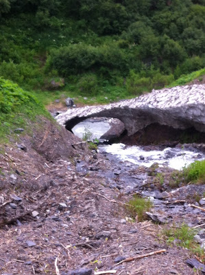 |
| Even the stream crossing in an avalanche chute was a cinch |
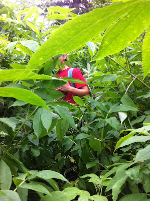 |
But when the trail became like this we got cranky!
Yes, Aurora is on the trail and so am I, just a few feet away! |
Amazingly, we persisted for 15 minutes of not seeing the trail, wading through the elderberries, pushki, devil's club and grass. The trail is under there, one just can't see it. You could tell we were aware of this as being bear country because we talked loudly about nothing, just to hear our voices, and because I got my bear bell out of it's pouch and let it jangle from my pack. At some point, though, we decided it was not going to get any better and we weren't going to see anything amazing so we turned around.
 |
| The only 'view' from Victor Creek Trail that we were able to discover |
Most trails "go" somewhere--an overlook, an amazing view, another trail, a waterfall. This trail acutally ends "abruptly" according to the trail description. Supposedly there is mining up this way, which is likely why the trail exists. It is a pleasant hike, until you get to the brush, but the only view you are likely to see is the one above, looking up the valley. If we're driving by and want a quick stretch, this would be my hike of choice. With few others on it, and being so close to the highway, it makes for a fast choice for getting on a trail.
 |
| Victor Creek is a typical Alaskan 'creek': fast flowing and gray with glacial silt |
That ended a day of 8 or 9 miles of hiking--plenty for us. An evening of relaxing in the campground and a good night's sleep rejuvenated us for the next day: the Primrose-Lost Lake traverse for Aurora and berry picking for Doug and I.
We dropped Aurora off early on Sunday morning in the Primrose trailhead, which was full of cars. Apparently the snow from 3 weeks earlier had melted and there were oodles of people camping on the trail this weekend. Despite warnings that a brown bear sow with cubs was sighted along the trail a few weeks prior, we were figuring the large number of hikers and bikers on the trail were going to be discouraging bear from hanging out on the trail. Off Aurora went with my bear bell and bear spray. Doug and I headed out berry picking. No, I'm not going to say where, but honestly, berries are EVERYWHERE. One cannot not find berries it seems to me. Well, maybe I am just especially attuned to them. I see berries everywhere. We picked blueberries until flies drove us nuts, then we went to the Seward end of the trail, 15 miles south of the Primrose Trailhead, to pick up Aurora.
 |
| Lost Lake Trail, not far from the trailhead |
I'm not sure why one end of the trail is called Primrose and the other half Lost Lake, but that's how it is. We hiked a ways out the Lost Lake end to meet Aurora. First we met at least a dozen bikers and hikers, though, including a couple bikers who told us they'd spent the day hopscotching with Aurora, with her ahead of them most of the time (running and hiking) and them catching her on the downhills (biking). As they said, "She was booking!"
Thus ended our weekend of camping and hiking. It was delightful to check out some old and some new areas and trails. We introduced Doug to the gelato shop in Seward; Aurora guided us to the picnic pavilion along the bay. I masterminded the trip and tried to make sure everyone got something that they really enjoyed from the weekend. It was a memorable one, particularly as it was likely Aurora's last camping trip in Alaska before she heads off to college. Good memories!


No comments:
Post a Comment