Friday, August 22, 2014

East End Road Construction 2014

The agony of this summer has been traffic delays nearly every time we drive into or from town. Road construction from about mile 3.5 to 5.0 on East End Road as they redo ditches, replace all culverts, move power lines and build a bike path has us scratching our heads daily. They dig out the dirt, then fill it in, push the dirt around, dig it out and then fill it in again. There seems to be no rhyme or reason to all this dirt moving. 

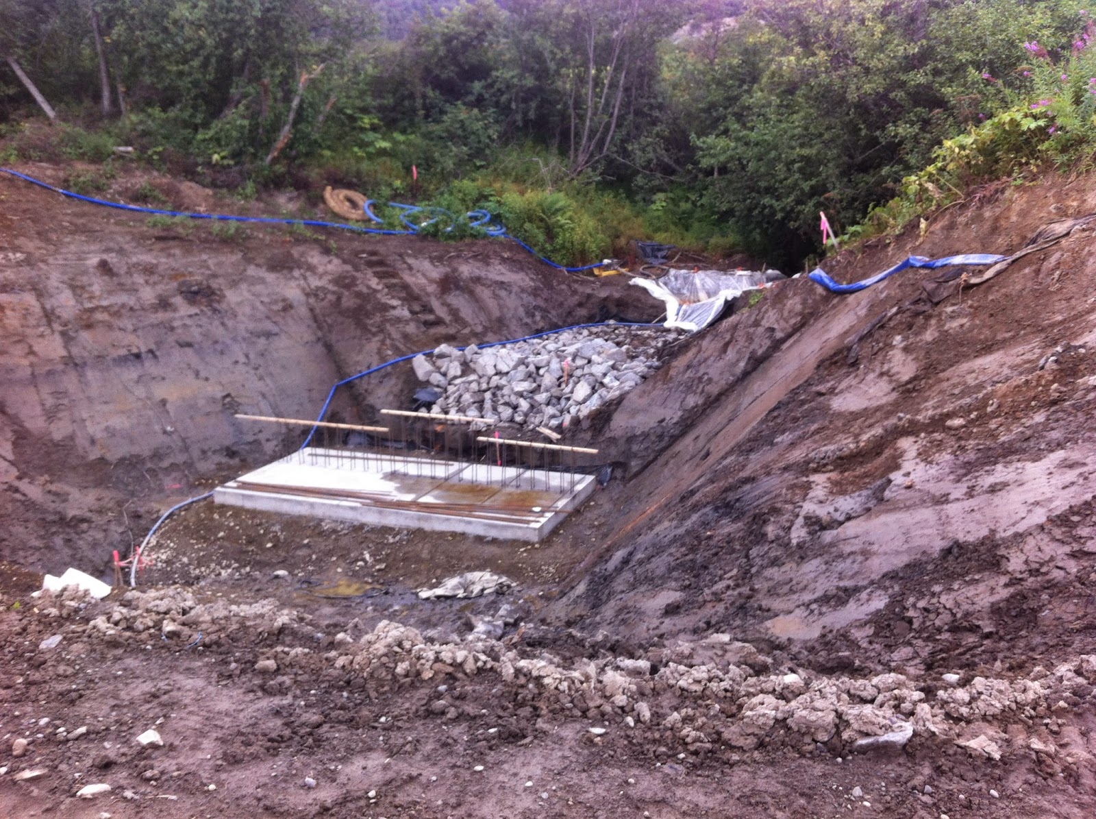
Large concrete forms have been built for culverts to handle large amounts of water coming down from the bluff

Just a typical construction view...recent rain has probably been slowing things down

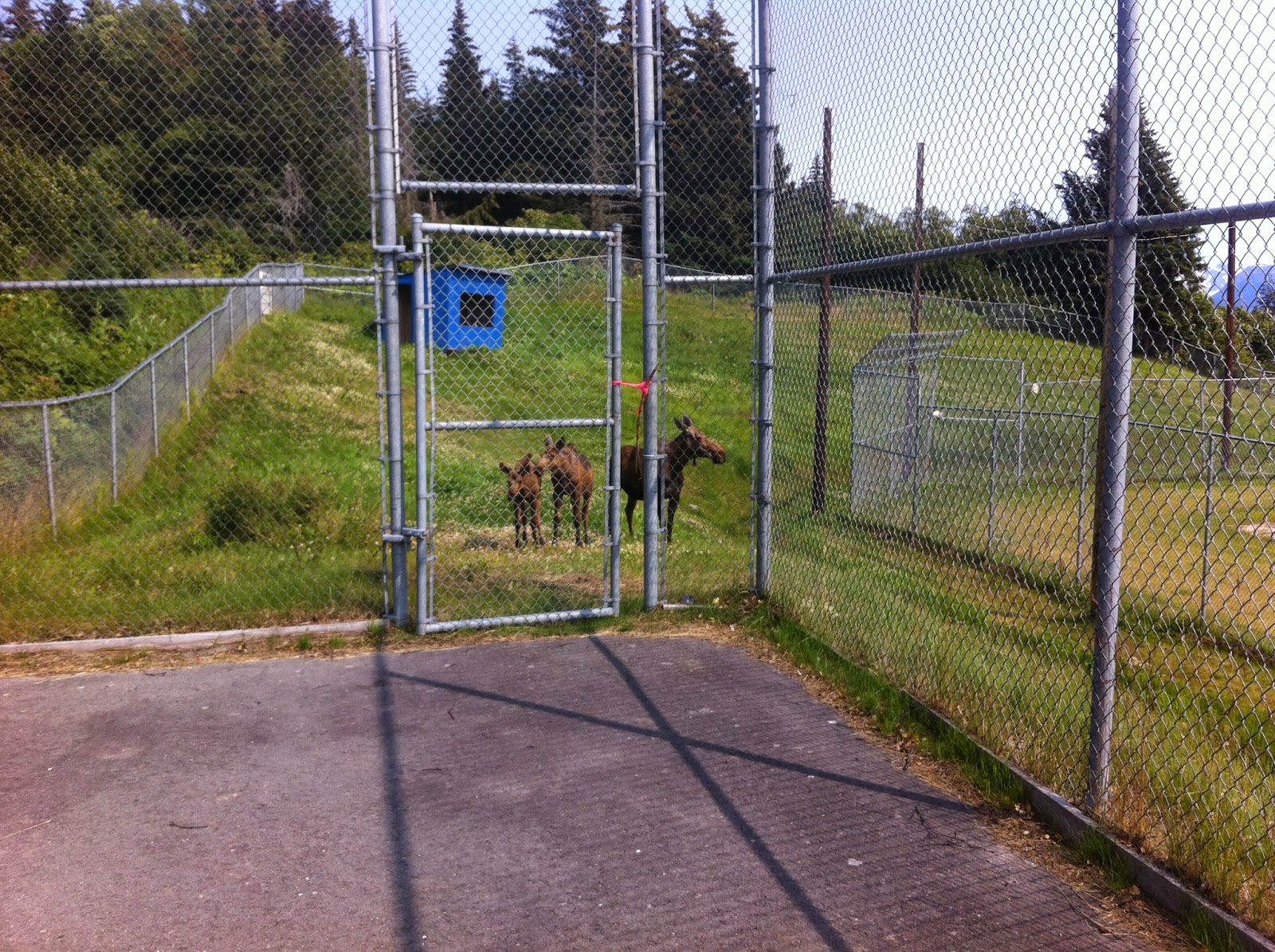
Ravines along this section of East End Road are deeper than one realizes
A 3 foot deep, 1 foot wide square-cut ditch runs the entire length of the project, with plastic drainpipes sticking up out of it at regular intervals. Tybar, the heavy duty black tarp-like stuff they put down under the roads is rolled out, waiting for fill to cover it up and the road to finally be widened. It took nearly 2 months just to move all the telephone and electric lines on the bay side of the road to the bluff side and take down the poles.

Each of my two to three trips to town each day are punctuated by 10-20+ minute waits, unless I am lucky enough to catch the line just as it is beginning to head through the construction area. The flaggers are as familiar as family, and yesterday I had the misfortune to turn off my car while waiting and when the line began to move I discovered it wouldn't start so a flagger had me put the vehicle in neutral and pushed me to the nearest intersection. I now plan my waiting-in-the-car activities: read my email, open the mail, check Facebook or make phone calls. On the good side my kids know better than to ask me to run them to town, because a "run" to town means an hour round trip. We try to go before 8 a.m. or after 8 p.m. when the road is open without delays.

While waiting in traffic one day recently Denver was asking me about the road project and I suggested he get online and look it up. Apparently this is a 6.5 million dollar project, with 90% of it being paid for by the federal government. The bike path portion of it is $800,000, so it seems like that part is being paid for by more local (state or borough) monies. It is a 2-year project, which staggers me that we'll have to deal with this next year too. For what?  One and a half miles of gorgeous road and more bike path? The road wasn't great, but I didn't think it was that bad either! And of course we are just hoping the road is paved before winter. We have had more issues with car repairs this summer than all the other years we've lived here, many of them bump-related repairs, which seems like more than coincidence.

What really strikes me each time I drive through the construction zone is how little I know about road-building. I can't even venture a guess for some of the things that they are doing. On one hand it gives me more respect for a career where folks can figure out things like this and run heavy machinery like pros; on the other hand I wonder if they even know what they are doing and if our taxpayer dollars are being drained by projects like this. I just don't know, and I am really, really curious to see if the road and ditches they create actually can handle the insane water and ice issues that develop in this area in the winter. Time will tell. Come to think of it, I should have written this blog post while waiting in traffic.

Sunday, August 10, 2014

Moose Hanging Out...at the Tennis Courts


The little ones are curious about what we're doing

We've been playing tennis just about every sunny day that we're in Homer this summer, which has been three to four days a week--quite a treat! The 4 courts at the high school court are pavement, but smooth while the 2 courts at the Kachemak Community Center are the hard tennis surface but bumpy so balls bounce funny and water pools. So we usually opt to play at the high school.

Moose hang out on the trails and in brush behind the high school and we see them regularly, since they are just outside the fence as we are playing. The other day we were still surprised to see a momma moose and two babies come up to the fence while we were playing and just hang out for 5 or 10 minutes. Momma would get startled when we would hit the ball with a particularly hard thwunk, but the young 'uns just went about their business, lippity, lippity.

Monday, August 4, 2014

Lucky Strike and Hirshey Mines in Hope

We're back to the mines again. After getting partway up to the mines last summer on our trek out here, we had a rainy day in Hope that made climbing Hope Point out of the picture. You can check out my blog post about visiting this area last year, July 2013. This time was much more interesting and exciting, though.


The road to the Couer d'Alene Campground  wasn't as wide as I recall but it was still close to washboard free, impressive for a gravel road. The view was still awesome with a deeply remote feeling to it. Past the campground up to the end of the road has been improved (looks like recently--this summer) so I could go 25 mph instead of creeping at 10 or 15 mph over giant potholes. The last mile is still rough but nothing a sedan can't make it through.

Palmer Creek as it gushes downstream

View of the valley on a rainy day from a spot almost to the first mine
As before we hiked up the trail towards the mines, which are not visible when you first start out, crossed Palmer Creek, climbed up over a ridge and then we could see the mine tailings spreading down the mountainside. That was our goal.

This is the jumble of rocks that met us at the end of the trail, just above the mining tailings. Disappointment!
Going at a steady pace it only took us 30 minutes from where we parked to reach the first mine. It was just a jumble of rocks, so I figured it was plugged up. The road-like trail ended, but this time I noticed a trail climbing up above to the right of the mine, so we pressed on. It seemed not 50 yards further we came to another mine, this one still open. We didn't have a flashlight, and it looked like sections had caved in, but it was neat to see the wooden structures still present. There was a pile of snow just inside the entrance as well.

The trail past the first mine turns into a minimal path along the side of the mountain

We were startled to discover a second mine along that path

The mine doesn't look very deep (40 feet or so--as far as we could see without flashlights), but old wooden structures are still evident

After checking out the mine I noticed (again!) a trail that continued upward, this one even more faint than the last. We pressed on. I was determined to get to the top of this mountain rather than go all the way down to the stream crossing and follow the trail up along the waterfall. Well, it was a little hairy. 

A messy, wet near-vertical scramble up the mountain sans trail above the second mine

The trail soon petered out and there was loose talus that we slipped and slid on. The climb was pretty darn close to vertical. Each time we grabbed a rock to pull ourselves up on, it would come loose. So I am totally not recommending that route up. It wasn't far--15 or so minutes from the second mine until we reached the top.

Ah, but it was worth it! The view from the top was amazing! If we'd stopped on our scramble we'd have seen it too, but to me it was more beautiful for being on flatter solid ground.

View from on top--comfortable walking with view of craggy mountain peaks
The top was wide and relatively easy walking on moss and rock-covered ground. The ridge-top stretched off to both sides of us. Below us we spotted a cairn on the back side of the mountain we'd just climbed so we headed for that, expecting to find a trail. There was no trail, but from that cairn we found another and another, angling us back up the mountain. Eventually we looked into a higher bowl and saw the remnants of a dying glacier. When we got back Homer Denver pulled up the area on Google Earth and the photo from 2010 showed a glacier substantially larger than the bit that was left. Once again, we are saddened by the disappearing glaciers.

Only 4 years ago there would have been a lot more glacier to view
Then we followed the cairns back down to the two beautiful lakes that are tucked in the mountains and which feed Palmer Creek. 

A beautiful alpine lake

Amazing plethora of crowberries

Palmer Creek waterfall

The trail down by the waterfall
After crossing at the mouth of Palmer Creek, we headed down a well-worn path back to the road.

What a gorgeous area! And as we were leaving we saw another trail going up a different mountain and said, "We have to come back. There's another trail to explore!"