Tuesday, June 6, 2017

Revisiting Hope 2017

Hope is one of my favorite places in Alaska to visit, with some of my top activities:  camping, hiking and mountain biking. As Douglas headed up to Fairbanks to provide administrative coverage for softball state, the kids and I headed to Hope for a long weekend of fun.

Gate to our campground of choice was closed
However, the weekend took an unexpected turn when we arrived in town, because the gate to the Coeur d'alene Campground was closed, where we were planning to camp out at and make our base to explore from. Luckily it was a Thursday evening so there were still spots open at the Porcupine Campground a few miles away at the end of the road. In fact, we even got an ocean front view spot, quite a rarity and I was questioning how that was possible until the next morning when we were informed there was a mistake and we needed to move to another site.

A view of Turnagain Arm from the Porcupine Campground
The next day we decided to bike the road that was closed to the campground. It turned out that an avalanche had covered the road and was still deep enough to make the road impassable. As we discovered when we biked out there, the mountains are still completely covered with snow, so we wouldn't have been able to do all the exploring we'd hoped to do, so it was a good thing we weren't all the way out there. 

I hadn't realized how far up that road climbed from the gate to the highest point, but it took me a full hour of uphill biking to reach that point (which, by the way, took me only 12 minutes to coast down on the return trip!). Whew! A downhill never felt so good, though I was soon stopped by avalanche areas--first branches covering the road from already-melted avalanches, then the one avalanche that needed to be clambered over.

The kids also climbed a 4200 foot peak off to one side of the valley, choosing one for it's lack of snow. They were rewarded with miles and miles of peaks in the distance, a treat they said was worth the climb.

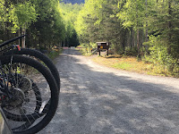
A summery day for a bike ride up the Palmer Creek Road

This avalanche is responsible for the road being closed.
Apparently plowing it isn't an option??

A couple of other areas with branches littering the road are
telltale signs of avalanches that have melted already

The Coeur d'alene Campground is petite with 6 tenting only sites, but it is free and remote!

The mountains past the campground were still snow-covered, and warm temperatures
meant soft snow not conducive for exploring the mines and area

A beautiful view of Turnagain Arm looking towards Anchorage was worth
 braking for on my 12 minute downhill coast back to the gate

The next day we decided to climb Hope Point, and despite predictions of possible rain, turned out to be another scorcher by Alaska standards (65-75 degrees). I regretted not wearing shorts, figuring it would be cooler up higher. I was more comfortable once I rolled up my tights to my knees. The 2000 foot climb went by relatively quickly with the new switchbacks that lengthened the trail to 3.5 miles, but made it a moderate climb rather than a straight-up grueling one.  The main highlight was seeing 4 mountain sheep reclining on the rocks of a nearby peak as I reached the saddle for the final push to the top.
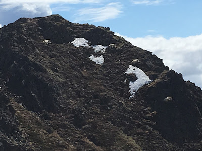
The mountain sheep looked like patches of snow at first 
The kids have been pushing their limits beyond trails this summer, so after reaching the summit of Hope Point, moved on to another nearby peak.

View of a nearby peak the kids climbed, as seen from Hope Point
Our final day, the kids decided to bike the entire length of the Resurrection Pass Trail, all 36-39 miles of it (depending on which trail map to believe; Denver's GPS said it was 37.65 miles). This was going to be a stretch for them, as the longest mountain bike ride they'd done before was 25 miles on the Russian Lakes Trail a few years ago. We plotted and planned, packed backpacks and filled waterbottles, and at 7:30 am the next morning I snapped a picture of them before they headed down the trail, looking all clean and eager.

Juneau Falls off the Resurrection Trail, swollen with spring runoff
They estimated, on the high side, it would take them 12 hours to bike it. My guess was 8 hours, which would put them just over 5 mph. That meant I had a long day to fill before picking them up at the other end of the trail, in Cooper Landing. But between getting breakfast, breaking camp, and driving to the Cooper trailhead, I had a little bit of time before the early estimate of 8 hours. I hopped on my bike and headed up the trail, with my goal Juneau Falls 4.5 miles away. It took me 50 minutes of mostly uphill to get there, and just as I was getting ready to hop on my bike to head back, the kids pulled in on their bikes. I snapped a quick picture of them in front of the falls, now looking tired and muddy, and we careened down the final miles to the trailhead.

It was an intense weekend of hiking and biking, and we returned home sore and happy having fulfilled the goal of summer in Alaska:  adventures!!
Thursday, June 1, 2017

South Fork Eagle River Trail

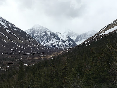
Looking up Eagle Valley towards our destination, Eagle and Symphony Lakes

Last year Doug and I were killing time between events in Eagle River and were randomly driving down roads. We drove down one just off the first Eagle River freeway exit. There were no houses at first, but the further we got up the valley, the more houses there were. And then we saw a trailhead sign, which is nearly irresistible to check out. Ironically, when we pulled in we ran into a lady we know from Homer, who said this was her favorite hike in all of Alaska because it is mostly above treeline and fairly flat. That day, an ambulance was parked in the parking lot, as a young girl of about 10 or 12 had passed out while camping with her family and was being hauled out by medics.
The Hanging Valley Trail to the left will be
one of our places to explore another time

We put that hike on our "someday" list, and that someday came last week since state soccer was in Eagle River and track in Palmer so we were in the area for four days. There are other trails besides the South Fork Eagle River Trail, but we decided that would be a good one at 11 miles round trip to Eagle and Symphony Lakes and back, with less than 1000 feet elevation gain.

The trail was in very good shape the first half with hard-packed gravel and dirt, while the second half, when getting into the muskeg, was a bit boggy in places. Once we reached the terminus of Eagle Lake and the bridge, it was a mile of boulder hopping to a shelter between the lakes. There were lots of people on the trail, many dogs, and an impressive number of backpackers who were going to camp in the valley overnight. There was no sign of bear, but the kids went along Eagle Lake around the corner to look up the valley to Finger Glacier (out of sight) and saw bear tracks up that way.

View of Eagle Lake from the shelter between the lakes

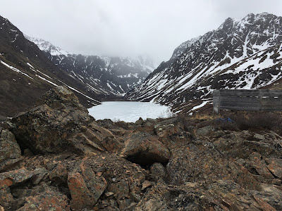
Symphony Lake, still frozen

Eagle Lake with shelter

Much of the trail is in good condition

Overall, it was a nice hike, and 11 miles went by quickly. It was a bit windy at times, and snowflakes floated down at times, though it was in the 40's. It was also nice to be able to scout out other possible hikes, such as Rendezvous Peak, which begins at the same trailhead. I saw some folks coming back to the parking lot with downhill skis on their backs, so they were likely catching some late season snow up top.