Sunday, August 13, 2017

Climbing Poot Peak

Conical Poot Peak, rising above the foothills across Kachemak Bay on a misty day


Climbing Poot Peak, the 2880 foot peak across Kachemak Bay from us, has been a goal for our kids for a couple of years. With Aurora's imminent return to college, and Doug's return to work for the new school year, the opportunities to head over there have been dwindling. With that narrow window in mind, I called Mako's Water Taxi to find out when we could get in and out on high tides during this past weekend. Halibut Cove Lagoon is the entrance to that area, with a dock and maintained trails. However, it is only accessible a few hours before and after high tides so it limits getting in and out. With the current tides we were able to get in mid-afternoon on Saturday and out early Sunday evening. That gave us 26 hours to backpack in the 2.8 miles to China Poot Lake, hike up Poot Peak, and backpack back out. It was a full weekend of hiking, but wasn't unreasonably so.

 A cabin is tucked onto an island on China Poot Lake, accessible only by float plane or boat

Poot Peak rises above the trail as one hikes out to the lake

China Poot Lake as seen from the north route up Poot Peak

The hike to China Poot Lake is fairly well maintained--not overgrown with brush and with relatively few roots to get over.

The campsite on China Poot Lake aleady had two tents set up, so it looked like it was going to be crowded by Alaska standards. After setting up camp, we went out for a walk, which on my map the trail was flat, but that must have been within the lines, give or take 100 feet, because it did go up and down plenty. And while it was a "walk" because we didn't have our backpacking backpacks on, it was still most definitely a "hike" on the rough trail with occasional splotches of berry-filled bear scat.

A fire ring offered a less rustic feel to this backpacking experience, and we enjoyed a few hours around the flames. A bear container was convenient for our foodstuff, but we also hung one backpack on the cable strung between two trees for that purpose.

The next morning the kids headed out of camp by 9:30 with their daypacks on, heading for the summit, while Doug and I cleaned up camp and pumped water for our waterbottles. Our goal was up the mountain, hopefully to the nob (that sticks out of Poot Peak near the top), but not the summit. Everyone we'd talked to had done the North Route, which was unmaintained, even though the South Route was supposedly maintained, so we headed up the North Route. And UP is an accurate description. Up and up and up, sometimes very steep, slippery slopes and then near the top, a more gradual up through a mountain meadow.

Glaciered mountains in the view from the nob on Poot Peak

Rugged peaks in the Kenai Mountain Range
The final trek to the summit rises behind this sign

We made it as far as the sign above, which marks the final climb to the summit, which includes a scree slope and a bit of rock climbing. A little lunch and lots of water later, we headed down, packed up camp, and headed back to Halibut Cove Lagoon for our water taxi ride back to Homer. As the kids said (in my words, paraphrased!), it was the most unremarkable peak they have ever climbed. Although it is 2880 feet, and it rises above the surrounding area, it doesn't have this awesome grandeur feeling that one gets on Grace Ridge or even Alpine Ridge. It rises by itself and is just a hunk of rock, with passable views, but only near the top. Camping at China Poot Lake will definitely get put on my list of regular hikes, to explore the area, but making climbing Poot Peak will unlikely be the goal. But one has to do it to know it, and now we can say we've done it. Check!  

Saturday, August 12, 2017

The Saltry and Danny J--A Halibut Cove Experience

Last week I did the most touristy thing I've done since coming to Alaska:  take the Danny J to Halibut Cove and eat at The Saltry Restaurant. It was an enjoyable thing to do for a low-key evening: beautiful ride, good food, nice company and even view some wildlife.

Heading out the Homer harbor

Halibut Cove with Poot Peak rising above it


Lighthouse guarding the entrance to Halibut Cove, now a vacation rental

The local arch to the left of the lighthouse

Cute sea otter entertaining us tourists


The still waters of Halibut Cove

Ripples across the cove

An art gallery featuring local artists is one of the few businesses in the cove

An idyllic view

Fireweed and fields

Quaint local directional signage

Boardwalks are the local streets in Halibut Cove

Enjoying a tree-shaded boardwalk

Some houses are quaint; others are old; all add to the atmosphere of Halibut Cove

Boarding the Danny J, a restored wooden boat
If the weather were rainy, windy or cold, this wouldn't have been as enjoyable. As it was, the overcast day was warm and calm, so five hours outside on the boat ride, wandering about on the trails and boardwalk and eating in the outdoor venue at The Saltry were pleasant. As a bonus we saw a black bear on shore as we were leaving the cove, topping a delightful evening outing.

Friday, August 11, 2017

Summit Lake Area

Exploring is the buzz word of my summers. Each May our family comes up with lists of mountains to climb, trails to hike and places to camp. Some people go back to the same places year after year. We like to always be finding new spots to explore. The Summit Lake area was on my bucket list for this summer, so come mid-July and a few days free, my hubby and I headed to the Tenderfoot Campground that sits on the back side of Upper Summit Lake just off the Seward Highway.

But first for a gem we discovered on the way there:  the Tern Lake Rest Area/Picnic Area. We'd only stopped there once before and hadn't ventured out of the parking lot, but this time we decided to check out the unmaintained dirt road that leads out of the Tern Lake parking lot, just to see where it goes. It went further than we wanted to hike! The sign stated it was the old Sterling Highway, so I'm guessing it goes all the way to Kenai Lake in Cooper Landing. It had gradual climbs and big potholes (we wouldn't want to drive it with our vehicle!), but it would be perfect for mountain biking.
A perfect road for a mountain biking jaunt

A beautiful little waterfall along the road


On a nice day the Tern Lake Picnic area is a beautiful stop
On to the Tenderfoot Campground! One of the features of this campground is Summit Lake Lodge practically next door, with full service restaurant as well as a pizza and ice cream shop next door, both on the gorgeous Summit Lake. There are also all sorts of side roads, two tracks and trails to explore, and we spent our days driving from one pull-off to the next, taking the trail as far as it would take us before it petered off into nothingness, the wilds reclaiming it.

A trail up the mountain near the campground was a neat mountainous meadow that ended up in a bog

One random discovery of the day that made me go, "Huh?"

Mountains and meadows...this one following the powerline across the highway from Summit Lake
The most substantial hike we discovered was what I will call the Colorado Creek trail. It was unmarked and unnamed, but went up the valley that Colorado Creek came rushing down, parallel to Devil's Creek and Summit Creek to the south.

When heading south on the Seward Highway, cross Colorado Creek

Just past the creek on the right there is a gate
Can you tell where the trail begins?
It took a sharp eye to see it, and trust that it wasn't one's imagination, but it is straight ahead!

The lower reaches of this trail were the best, climbing through a mossy pine forest

Balancing up a fallen tree was one of the gymnastics of this trail

Views upvalley were rare, and it looks like most of the trail stays in the brush below treeline

Avoiding muck became more common as we went further up the trail
It would take some work to turn this trail into a "trail" that could handle any amount of traffic. I can see why it hasn't been developed:  it stays in the brush far upvalley, while Summit Creek Trail one valley to the south offers impressive views within minutes of being on the trail. However, it was fun to explore. After awhile we figured we weren't going to see anything we hadn't already seen (more alders, more muck) so we turned back.

On yet another side jaunt, we discovered a mining claim on a stream, a cute bridge over a rushing mountain stream, and a potential place to stay on future outings:  Manitoba Cabin. Since we had internet access, I immediately Googled Manitoba Cabin and discovered it is two yurts and a cabin for rent, fairly inexpensively. We could hear kids laughing in the woods from a ways off, so we didn't actually go to the cabin, but did save the website for future reference:  https://www.alaskahuts.org/.

A cute little road leading to Manitoba Cabin

Love all the little bridges we see around on our hikes


Overall, it was a very fun trip exploring all sorts of side roads I've wanted to check out for years. It has just whet my appetite for more, and I look forward to next summer and camping in the area again and seeing what else we can discover!

Thursday, August 10, 2017

Alpine Ridge Trail

When we lived in Arizona and then Michigan, we explored everywhere within a weekend trip radius around where we lived. When we'd exhausted our list of places to go, we got the itch to move on. This year marks the 10th year we've lived in Homer (and I've been blogging about it!), and we still are finding all sorts of places nearby that we've never checked out. The Alpine Ridge Trail across the bay in Kachemak Bay State Park is one of those trails that has popped up on our radar a few times, but that we had not made a priority to get to. This summer it came up 3 times:  our dental hygenist mentioned it, the cross-country running team was hiking/running it, and a friend told us she liked it more than Grace Ridge. Well! Time to check it out!

Aurora had a day off and I was available, so we decided to dash over one Sunday in July. We were blessed with nice weather, and I was grateful that the grass wasn't wet with rain or dew as we climbed the Saddle Trail from Halibut Cove, and then turned onto the brushy Alpine Ridge Trail.

I was thoroughly entertained by the rotten? chewed? sign that was only partially legible. It is a sign of the times in Kachemak Bay State Park. I hear it is the largest state park in the country, but maintenance is minimal. Well, in some areas, as you will continue to read this post!


Gorgeous views of Halibut Cove, the spit, Kachemak Bay and Grewingk Glacier and Lake are features of this hike, though it takes a bit of climbing to get to them.


A feature I'd never seen before but thoroughly appreciated was the rope system:  in really steep, muddy sections (maybe six spots total), a rope was tied to a tree and one just had to grab on and climb like rappelling. In the picture below, it looks crazy steep and nervewracking, but it was never as bad as it looks.


I even have a smile on my face as I'm climbing, so it can't be that bad! It doesn't even look steep here!

Views above treeline opened up stunning vistas

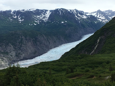
Grewingk Glacier and a bit of the glacier lake, as seen from Alpine Ridge

The trail continues on up these hummocks.
We turned around as there was a large black bear foraging ahead of us in that area

Here is the panoramic view of the area from the overlook:


This section didn't feel overgrown since it was "just ferns"

Another view of Halibut Cove Lagoon, at low tide
Because our hike up Alpine Ridge was shortened due to a bear on the trail ahead of us, we decided to take the Lagoon Trail which branched off from the Alpine Ridge Trail. Ha! What an eye-opening, learning experience! Even my uber tough daughter said it wasn't worth it after less than a half mile of climbing over and under huge logs, falling into the brush, and squeezing between trees. It felt epic. As we found out later, they tried to re-open the Lagoon Trail a few years ago after so many spruce beetle killed trees fell on the trail, but after a quarter of a mile they gave up. The wilds of Alaska have reclaimed that trail.


After that expedition, we decided to do a quick jaunt over to the Grewingk Glacier Lake. I knew they'd been working on a new trail from the top of the Saddle Trail over to the glacier outwash area, but hadn't seen it, so figured we had some time to do so. The new trail feels like a superhighway through the woods. I'm sure once the scar of construction wears off and it grows up, it will be very nice. The trail wasn't open yet, but we didn't realize that until we met one of the three crew members who is working on this multi-year project. He warned us there were others ahead. The next gal we came across was digging out a huge boulder out and warned us not to return on this trail since she would be using dynamite to break up the rock.


There were a lot of icebergs on the glacier lake, and folks sitting on the shore mentioned seeing hunks breaking off of icebergs as well as the glacier.


The most entertaining part of the trip was returning to the Saddle Trailhead at high tide. There was hardly any beach left because the tide was so high, and I counted 35 people sitting on the rocks at the base of the trailhead stairs waiting for water taxi pickups. It felt like a party, of strangers, except when we knew some of the folks, though many of the Homerites had their own boats moored offshore.

It was a good day of being out there enjoying Alaska wilds. Next time we hope not to see a bear and to push on up the ridge where I hear one can get views of the Harding Icefield. More areas to explore! Guess we'll have to stick around Homer longer!

Wednesday, August 9, 2017

Bear Canyon Trail, Homer

I thought I'd hiked every trail in Homer, but this summer I noticed a hand-made sign at the intersection of East End Road and Bear Creek Drive:  Hike Bear Canyon.


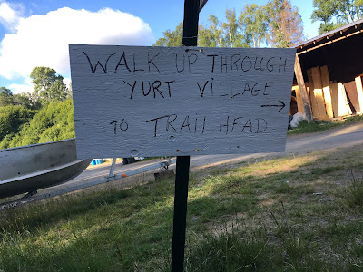
Hm. A hike I'd missed?! One nice, summery day I dragged my husband off on a treasure hunt.  Following the signs up Bear Creek Drive, we ended up in the "new" yurt village (where the yurts are made), and followed the instructions on more handmade signs to "park here" and "trail starts past the yurts".


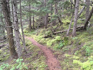
It was a typical Alaskan trail in that it was very grown over and brushy, particularly at the lower elevation. It takes a lot of work to keep back the frenetic growth of summer:  pushki, devil's club, alders, elderberry bushes, grass and more. 

This is a section of trail that is not overgrown!
I was grateful for occasional signs continuing to point out that this was indeed a trail, although the one pictured below was near the end of the trail as we could recognize it.


Bear Canyon is an impressive canyon, and we got occasional glimpses of it through the trees. In all these years, I'd never realized it was there. There were also the scattered Kachemak Bay views.

A rare meadow and view up the Bear Canyon Trail
After getting to the point of no more trail, we turned around and took a different (maintained!) loop back. It took us through the Canyon Trails subdivision, and, truth be told, likely the reason for the existence of this trail:  advertisement for these lots. Taking a different way back meant walking on the Bear Creek Drive a ways to get back to the yurt village and our car, which wasn't bad as there was very little traffic and the neighborhood was interesting.


Heading down a road in the Bear Canyon subdivision

Guess I'm doing my part to advertise this subdivision!
So while this wasn't a difficult hike, it was a steady uphill the whole way and had the added challenge of wading through some tall undergrowth. It was something different, but not a hike I'd want to do every day.