Tuesday, June 28, 2016

Sandhill Cranes in the Neighborhood

In the seven years we've lived in this house, we've never had the sandhill cranes visit our yard, at least not while we were here. There are certain lawns they regularly inhabit, and I figured those folks feed the cranes. But this past week, the cranes moved in, stalking about our yard, their flock growing from three to nine, as additional birds flew in. Apparently the eating was good, and we weren't feeding them.


It was fascinating watching them aerate our lawn:  big, long beak poked into the earth and wiggled about, repeat, again and again for hours, by all the birds. It is the most natural lawn aerating I've ever seen. The robins just poke in and out, quickly grabbing their worms, but the cranes really worked the earth as they poked.

One evening as we drove in, the cranes were lying sleeping, standing about not feeding quite as actively, but they did not stir as the car pulled into the drive 15 feet from them. Nor did they stir as we got out, and as I walked by them to water the greenhouse. Sometimes they seem timid, and other times they seem indolent, not inclined to move out of the way when standing about on our road.

Watching them fly is fascinating as their long legs just hang behind them, looking incredibly ungainly.

Here is a view of the cranes as they strutted about our yard:


Our cat and the cranes have an interesting relationship. Our cat will slowly walk across the driveway towards the flock, tail waving languidly, and the flock will slowly move away. Our cat will then sit down and watch them for a few minutes. They watch him back. Then our cat will walk away, and the cranes will follow him! They match his pace, and they keep the same distance from him at all times-never closer than 5 feet or so. Neither seems overly bothered by the other, but they are definately aware. It is interesting for us to watch from the house or the deck, as the cat advances, then the birds advance, back a forth a few times. Our cat ignores moose in our yard, seemingly unaware of them, and he reacts with hisses to dogs or other cats on the property, so this is a unique relationship!

Monday, June 27, 2016

McHugh-Homestead-Turnagain Arm Trails

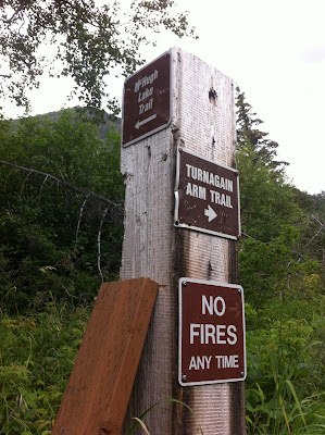
We hiked the section south of the McHugh Creek trailhead just south of Anchorage years ago (dubbed the Rainbow section), and I'd gone north towards Potter Marsh on the Turnagain Arm trail as well, but ton this day our destination was up! I knew the McHugh Peak/Lake Trail was in the vicinity of the McHugh Creek trailhead, but the maps at the trailhead wasn't showing it. So upon starting out, Doug and I opted to go straight at the first intersection we came to, and that ended up being the Homestead Trail, which doesn't appear on any of the posted maps or my topographic map that I had in the car. It did have a sign that labeled it, and it is a well-established trail, so I'm not sure why it doesn't show up. Doug and I took that for an hour, which led us through a cottonwood forest, up into alpine meadows, through a recently burned area, and finally it connected with the McHugh-Rabbit Lake Trail (which does show up on maps). As far as we can tell, the Homestead Trail parallels the McHugh-Rabbit Lake Trail until it jogs up and meets it.

The kids didn't know the trails as well as I did, and were up ahead, so they ended up going along the Rainbow section of the trail, then back to the McHugh-Rabbit Lakes Trailhead, then they went cross-country and started to climb McHugh Peak until it started raining and the wind picked up, at which point they decided it prudent to get off the mountain (for which I am grateful for their good judgement!).

So for anyone who plans to do this hike, just minutes south of Anchorage, here's a map of the trails, and my advice is to look up the map before you go (don't count on the one at the trailhead!) if you're trying to get somewhere specific. The elevation gain is mild an hour or so in any direction so this can be a nice day hike area.

This sign ought to be in the McHugh trailhead parking area, but instead is down one of the trails a ways.

The Turnagain Arm Trail runs 9 miles from Potter Marsh near Anchorage to Windy Corner

The McHugh-Rabbit Lake Trail heads off the Turnagain Arm Trail north of the McHugh Trailhead area, with McHugh Peak in the background
Cottonwood fluff along the Homestead Trail


Huge cottonwood pucks act as steps across a muddy section of trail

There was a small but recent forest fire along the Homestead Trail, still smelling of smoke

Fireweed with the remains of a burnt tree (fire, indeed!) along the Homestead Trail

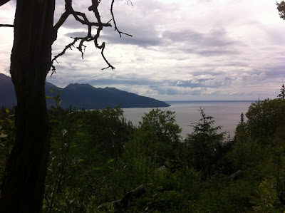
A nice view of the mouth of Turnagain Arm and into Cook Inlet from the Homestead Trail

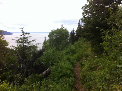
A nice, comfortable trail:  Homestead Trail before it intersects with the McHugh Lake Trail


Friday, June 24, 2016

Revisiting Cooper Landing...A Short Camping Trip and Some Hikes

Following Denver's schedule with 2 1/2 days off each week, we've been hitting all our favorite Kenai Peninsula haunts (aka hikes and campgrounds) this month as Aurora packs in as much Alaska as possible before she leaves for her summer job on the Aleutians and then college out of state. Last week our locale of choice was Cooper Landing. As luck would have it, the temperatures were slated to hit 82 degrees. Insane! This is the Kenai Pensula, not the Interior! We start melting at 65 degrees, but managed to survive the heat wave, which by the way, did not extend to Homer which was a pleasant 65 degrees that day.  As always, I get ahead of myself.

We opted to stay at the Quartz Creek Campground on the north end of Cooper Landing because it was closer to the hikes we planned to do:  Slaughter Ridge, Crescent Creek and Devil's Creek, and also because there is a pleasant gravel road to walk on for evening strolls, which cannot be said of the Cooper Creek Campgrounds. We did not go car camping once last summer as we backpacked, went across Kachemak Bay boat camping, and did day trips, so there were a few things that struck me about the campground. First, for a Wednesday afternoon at 2 p.m., it was surprisingly full. There were exactly TWO sites out of probably 50 that were available for two nights (a Wednesday and Thursday night). Crazy. 

Since when did Alaskan campgrounds fill up mid-week in June, even with gorgeous weather? Well, since folks with campers and RV's took over the campgrounds--and likely the reservation system adds to that. The campground was eerily quiet. The campgrounds I have known had kids playing and yelling, dashing around, biking and being very active. This campground had maybe 3 tents in the entire park, and 2 were on our site. Apparently tent camping is on its way out. And kids? I saw a few, but they were staying close to their site. Of course, our second evening there, a car pulled up to our site and a man honked to get our attention. Apparently a momma brown bear with a cub had just walked through the campground and they were warning everyone. Half hour later another lady stopped by and let us know the news again--probably slightly aghast that we were sleeping in tents--the courage we must have! We never did sight the bears, but we did batten the hatches and put more of our gear in our vehicle that night. No dishwashing rags left out to dry...

On to the hikes...
Slaughter Ridge would have slaughtered Doug and I had we attempted it. We were tired to begin with, and the sun was blindingly hot and the 3000 or 4000 foot climb would not have been pleasant. The kids did it though. They said it was hot and dusty, and they rewarded themselves with ice cream from Wildman's for their efforts. I say that was well deserved. I enjoyed my nap, thank you very much (gee, I'm sounding old!).

Since we'd skipped the big hike of the day, Doug and I still needed a hike, so we drove up to the end of the road 3-4 miles to the Crescent Creek Trailhead. This is one of my favorite hikes--and was more so because we met only 2 bikers the whole time we were out there. Part of this trail was ravaged by forest fires last year, opening up what is normally a deep, dark canopy of trees. Luckily, though, it was only a small section, maintaining the beauty of this trail which is a gradual uphill quite a ways, with some flat sections and a few short downhills here and there. It was perfect for our evening stroll, which we supplemented with an evening stroll on roads and trails around the campground as well.

The Devil's Creek trail winds along the valleyside

The spread arms was to catch the spray from the waterfall, a welcome relief on this hot day

The next day we decided to hike Devil's Creek Trail (which in my blog post 4 years ago I called Devil's Pass, and I only just realized I have been calling it the wrong name for years. It is Devil's Creek Trail). I enjoy that trail very much. It has no boggy parts, the trail is smooth and hard, there are no insane grades to make my lungs and quads burn, and the view once you get further up the valley is beautiful. Streams from snowmelt cross the trail intermittantly as you climb along the valleyside, so I would plunge my wrists into the icy water to numb them in a few seconds, then trudge onward.  The kids were able to hike/run the 10 miles to the intersection with Resurrection Pass Trail, and then back in 5 hours (yes, you read that right--20 miles), while Doug and I set our sights on 2 hours out and 2 hours back, which we figure was 10 miles total. We could have done more, but that was enough as the heat was draining. That trail was relatively busy, with 3 bikers, 2 backpackers and 2 dayhikers passed during our 4 hours on the trail. Ha! What standards we have! So spoiled!

Of course, after hiking Devil's Creek we had to eat at Summit Lake Lodge, which has a very nice restaurant for being, quite literally, in the middle of nowhere. It was an enjoyable cap to our day, gave us plenty of cold fluids to rehydrate (love the strawberry lemonade!), and gave us courage to go back to what we knew would be our very hot campsite.

Once again, Cooper Landing did not disappoint. It was delightful to go back and hike trails we'd biked on our trip there 4 years ago, seeing them from a different perspective. And the kids have grown up so much since that trip so it was a walk down memory lane to compare "then" with "now". For us, it is a relief to let the kids be able to hike their own rate and pace, and we just set parameters of time. For Doug and I, we don't go as hard or as far perhaps, but we're trying to be kind to aging bodies while still getting out there and doing things.

Sunday, June 19, 2016

#Erosion on the Switchbacks

As we were hiking down the switchbacks at the end of East End Road last week, we came across a gully that was deeper than the last time we'd been down that way. Aurora's comment was, "hashtag erosion." Little did she realize just how much erosion has been happening on the cliffs past the switchbacks. Her comment struck me as such a modern way of saying what has been happening for thousands of years. What amazed me the most about the erosion along those cliffs is that I thought of them as so stable because they haven't been eroding at the rate of the cliffs near Homer. And there hasn't been that much rain in recent months, but as we walked the beach, it occurred to me that the erosion had likely happened over this past winter during the nonstop rain we got for months (which at elevation was snow).

Here are a few pictures of the changed landscape in the few miles along the beach at the bottom of the switchbacks.

A large section of the hillside slumped off onto the beach

Another section of cliff gone, with alders littering the beach

A coal seam peeking out of the beach


The coal seam continues, with the bottom of the cliff crumbling away above

The coal seam rises out of the beach and into the cliffside


One of my favorite parts of hiking this beach:  the fascinating layers of geology evident

The different layers stand out in stark contrast

Piles of pebbles at the base of the cliff are new. Pebbles continued to fall even on this dry day.

The beach isn't quite as easy to drive now with alder carcasses crossing the once-relatively smooth surface

I admire this wild rose for making the best of a tough place!

Saturday, June 18, 2016

Visiting Exit Glacier, Seward

Eleven years ago we visited Alaska for a month before we moved here and Exit Glacier is one of the places we checked out. On a recent camping trip to Seward we wanted an easy hike (really, it is easy--the kids were pretty whipped from 23 miles of hiking the previous day) so we headed over to Exit Glacier to see if we remembered it. We did--but for our environmentally conscious kids, it almost felt like a funeral because the glacier has retreated quite a bit in the mere 10 years since we'd last visited, as evidenced by the year markers posted along the trail. And the trail to the glacier is longer than it was before, also a sign of the times.

The paved paths were just what we were looking for and we joined crowds of tourists as they explored the paved paths to the glacial outwash area and the glacier itself. Someday the hike to the Harding Icefield may be in our future--billed as an 8-9 hour strenuous hike. They offer it as a guided tour.

Here is a video of the glacier:


Friday, June 17, 2016

Crow Pass as a Day Hike

Since I was already in Girdwood, my family came up and joined me the last day and we did the hike I have been itching to do for years, since I backpacked it with a group of 25 folks from the Lower 48 about six years ago:  Crow Pass. I wanted to see if it was as beautiful as I remembered it, and as easy. It was more beautiful than I remembered it (perhaps because I was with fewer people so I could stop, look around and enjoy it more) and it was as easy as I recalled. We were doing it as an out and back.

From Alyeska Resort it was a 20 minute drive, up the gravel Crow Pass Road to the trailhead. The first part of the trail climbs through alders with only peeks at the mountains between them. Shortly one climbs gradually out of the alders and brush into the barren mountainous region of Crow Pass. An impressive waterfall thunders through a chasm to the left of the trail, with a narrow ledge one can scootch right next to the plummeting water. 

A relatively easy stream crossing before one reaches the top slowed me down a bit but I still managed to get to the the top in an hour, including a stop at the falls. I opted to get only to the level area I'd camped with the group years before. It was still covered with feet of snow this time. Further along was the Crow Pass sign, the "official" pass, and a glacier off the the right of the trail that one can walk onto if so inclined. We were not, particularly as the kids were planning to hike the Primrose-Lost Lake Trail that same afternoon so we were watching the time.

Here are a few shots of this relatively easy hike, which I hear climbs 3 miles and is at 3500 feet (not sure what gain that is).

Pussy willows were budding out and the snow is down to a few feet on the trail 

"Historical mining" apparently contaminated the earth in this area, resulting in this warning to not touch the soil or drink the water from this area which is on the way up Crow Pass

Mountains, mountains...it is a gorgeous mountain valley. This is looking towards Girdwood from partway up Crow Pass

Here is my humbly unprofessional video of the area--for a 360 view:


Wednesday, June 15, 2016

Winner Creek and Upper Winner Creek Trails-Girdwood

A conference at Alyeska Resort last week allowed me the opportunity to explore Girdwood trails a bit. Winner Creek is a fairly easy 2.5 miles to the hand tram. It has been about 6 years since I last hiked this trail and many improvements have been made. It is wider, with more bridges and steps over boggy areas. It is also extremely popular and I would guess it is one of the busier trails in Alaska. I saw one gal hiking it in 5 inch heels. Others were blasting their music to ward off bears. Plenty were running it. It is a gorgeous temperate rain forest with old growth trees and open understory overflowing with moss.

The 10+ foot wide graveled cross-country ski trails were new, and there is major construction at the beginning of the trailhead.

The Upper Winner Creek trail veers off at 1.5 miles up the Winner Creek Trail, continuing another 12 or 14 miles upstream to a beautiful mountain valley. I got 1.5 miles up that trail (past the turnoff), and as you can see below, the mountains come into view and you get closer and closer to them. This is actually a fairly level trail; I was impressed at how easy it was (at least in the early parts of it that I was on).

View of mountains as you get out of the trees on Upper Winner Creek Trail

An old bridge along the Winner Creek Trail

Impressive gorges with rushing water along the trail

A line for the hand tram

The new cross-country ski trails are impressive

I thought this was a road at first, until I came across the trailhead sign and saw it is a ski trail

Lots of construction at the ski trailhead

A stream diverted during construction

Quite an impressive culvert just for ski trails!

Lots of bridges along the Winner Creek Trail


Wednesday, June 1, 2016

The Best Stadium View in Alaska!

I am often struck while sitting at soccer games, track meets or football games what an amazing venue Homer High School has for their games. With a new turf field and track that gets extensive community and school use, it is an amazing benefit to the Homer area. At a recent girls soccer game, the view of the Kenai Mountains was beautiful enough to video and share.