The last week of May Aurora had a 5-day basketball camp in Anchorage. Douglas was still working so Denver and I planned on camping in Girdwood, hiking and biking, and then pick up Aurora after the camp was over. It didn't turn out as planned, as weather and snow interfered! Nevertheless, we had a great time exploring, so I thought I'd share some of our discoveries.

About 10 minutes south of Anchorage, you come around a curve and see a pipe sticking out of the cliff with water gushing out. This is good water, and very cold, so we usually stop and fill up any empty waterbottles we might have in the car. It is a popular stop, and many locals fill up with water there as well. I have seen people with a bunch of jugs or 5 gallon containers (done that myself!). So if you're inclined to try this water and brave running across the highway, check it out!

I figured that there had to be other campgrounds in Girdwood besides the parking lot at Crow Creek Mine, but I was wrong! With the Bird Creek Campground still closed (the one we were going to camp at--though we could have pitched our tent in the overflow area that is still open, but which is basically a parking lot), off we went to Crow Creek Mine. The last week of May the road was still frozen with a kazillion potholes, so the 2-3 miles back to the mine were torturous. But the plan was to bike the bike path from Girdwood to Indian, and this was to be the only base for that.
This is not a 'campground' in any sense of the word. It is a parking lot that they charge $10 a night for (up from $5/night just 2 years ago) you to park or set up your tent, with a bank of 4 portapotties available to use. There is no water or electricity, firepits or even picnic tables. I would go there again...if I had to. At 5 bucks a night it seemed reasonable, but 10? Just to park my car and pitch a tent between a bunch of campers? Argh. I think the next time I'll drive the extra 10-15 miles to the Portage Glacier turnoff and camp at Williwaw or Black Bear.

One of the hikes we really wanted to do was to the top of Crow Pass, a nice day hike of probably 4 miles, all uphill 2 miles up to the pass and then 2 miles back down. However, we'd enquired about it at the Girdwood Ranger Station and they said there was still snow on the road to the trailhead, but we were welcome to try it. The Crow Pass Trailhead is just pass Crow Creek Mine on the Crow Creek Road, so after we set up our tent we drove up there to see for ourselves. Sure enough, there was still at least a foot or two of snow on the road to the trailhead, and it was soft snow--not fun for hiking on--since it was raining. So that nixed one of our plans.
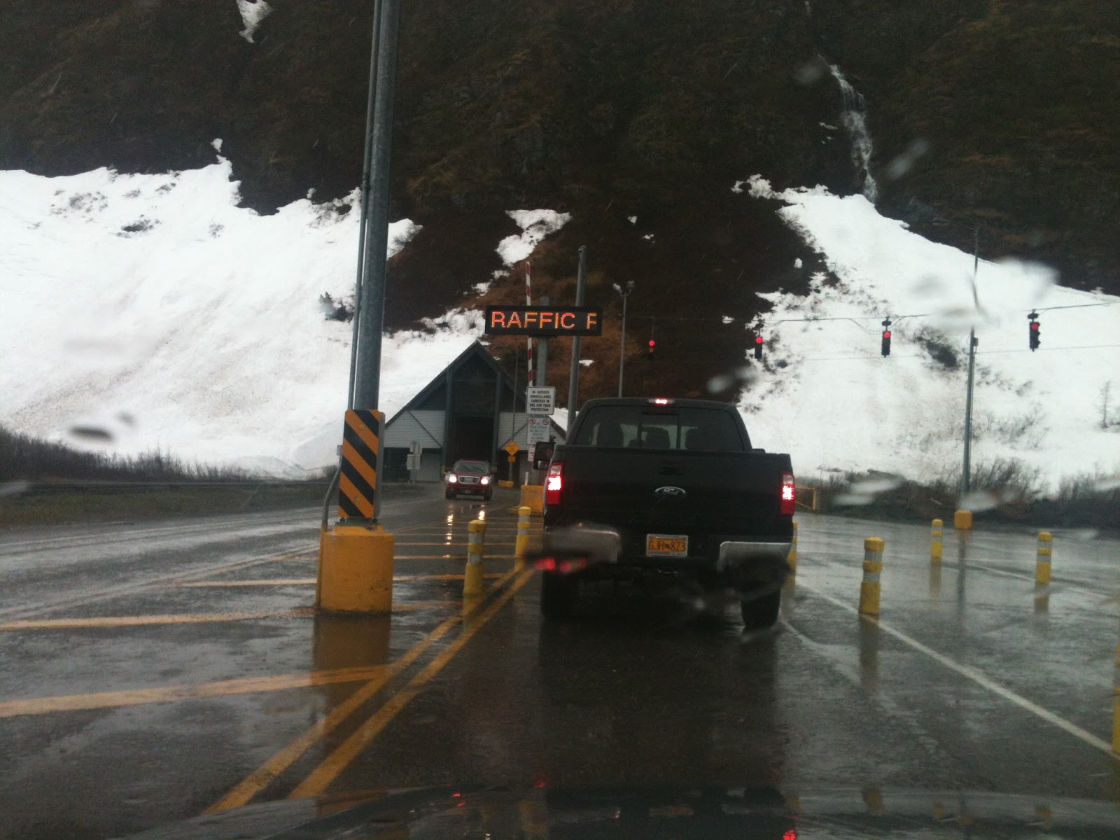
It was raining when we got to Girdwood and it continued to rain all night. When we got up the next morning we had to come up with yet another alternative plan since we didn't want to bike in the rain and wind. We decided to go to Whittier, about 15-20 miles away. We hadn't been there since 5 years ago in August when we'd had a glorious hike--one of the most beautiful I've been on in Alaska. That memory spurred us on. We drove to the staging area to drive through the 2-mile tunnel, waited 5 minutes and drove through, observing the rough-hewn stone interior of this car/train tunnel and trying to avoid driving right on the railroad tracks.

Upon exiting the other side we realized immediately that we would NOT be doing any hiking. There were 3 trails I'd wanted to explore: the Portage Glacier Trail that goes up over the mountain we'd just come through, and then a couple on the other side of town. The snow was deep--like, over our car deep. Remember, this is May 30th. So we drove through town and gazed longingly at the trailheads. It was still raining and the snow was soft and mushy and of course we hadn't brought our snowshoes (duh! How could we have forgotten them??!!) so we drove through the whole town (takes like 10 minutes), gaped at the old bombed-out looking abandoned building that once was the largest building in Alaska, housing troops stationed in Whittier, and at our lunch in the car at a cute little park by a stream. We drove back to the staging area and waited half an hour for the next time through (once an hour each way) as we'd just missed the last one. But it was rainy and miserable out and we had nothing much better to do.
Let me backtrack. Before we came to Whittier we stopped on the mainland side of the tunnel at the Portage Glacier Interpretive Center. While there we saw a graphic relief model of the entire Chugach Mountains, which extends from north of Anchorage on the Kenai Peninsula. What amazed me is that although the mountain passes were not labeled, I recognized and have been on many of the passes on various hikes (Resurrection, Crow, Johnson), and could name the passes that I haven't been on. Two things especially hit me: how mountainous this section of Alaska is and how every single pass has either a road through it or a trail. Not a pass is left untouched.
From Whittier Denver and I headed south, thinking perhaps it wasn't as rainy further south. We hiked a few miles in Devil's Pass (just a little snow left on the trail), explored all sorts of side roads in Cooper Landing in search of good hikes and bike rides, camped in Cooper Landing that night (some rain), then headed yet further south in search of no rain. We hiked the Skyline Trail (1 mile, 2000 vertical feet; 1 1/2 hours up; 45 minutes down was pushing it!). We ended up at Lower Skilak Lake Campground, which is a gem (sorry, no pictures! My phone charge was long gone by then and no car charger!). It is right on Skilak Lake, is free, and was very quiet as the boat launch was closed for repairs. Best of all, it didn't rain!!! We hiked a couple hours along the rocky shore (Denver found about 20 old fishing line with hooks in the rocks!), had dinner and read our books while snuggled in the tent (It was chilly! I wore my hat and neckwarmer, long underwear and other layers each night and still got a bit chilled).

Denver had a Boy Scout campout in Kenai for the weekend, so Friday we headed to Kenai to good weather and did a 10-mile bike ride on the paved bike path from Kenai to Soldotna. We met the rest of the Scouts at Spirit Lake for the district Camporee. There the scouts were busy kayaking, running around in the woods and doing whatever scouts do at campouts. I stayed overnight with them before heading back to Anchorage the next morning to pick up Aurora.
Of all the times I have seen Turnagain Arm, I don't think I've ever seen it glassy--until the morning I headed up to Anchorage. I was driving along marveling at how calm it was, and though I was pressed for time, I decided I absolutely HAD to stop and ride the bike path that just days before Denver and I hadn't been able to due to awful weather. As you can see from the picture above (taken from the bike path), it was one gorgeous day! There are certain days or moments that stand out in my memory from all my adventures in Alaska, and this one hour on the bike path was one of those idyllic memories I crave to replicate. It was sunny, dead calm, comfortably cool and the bike path was almost deserted (I saw 4 people in one hour). Flowers were blooming and the peace was palpable. It was amazing.

In the above picture I was heading back to Girdwood from my 10-mile ride and when I realized I had a perfect shot of Alyeska I had to stop and get a picture. The entire bowl that you see here is Alyeska, with the tram running up the slope on the left kind of where the trees are, and with skiers going as high as the peaks (heli-skiing). The lift goes almost to the top of the ridge on the left, before it turn and goes right.
Anyways, it was fun few days of exploring, with a bit more flexibility with just two of us. It was a great scouting trip as we were checking out the quality and access of trails for our biking trip that was only one week away!
No comments:
Post a Comment